Arola geodata
Arola (Piedmont) is a seat of a third-order administrative division; located in Italy in Europe/Rome (GMT+2) time zone. With population of 232 people, there are 10967 cities with bigger population in this country. Compared to other cities in Italy, 86.1% of cities are located further ↓South; 89.5% of cities are located further →East and 85.2% of cities have lower elevation than Arola. Note1
Administrative division(s):
- Level 1: Piedmont
- Level 2: Provincia Verbano-Cusio-Ossola
- Level 3: Arola


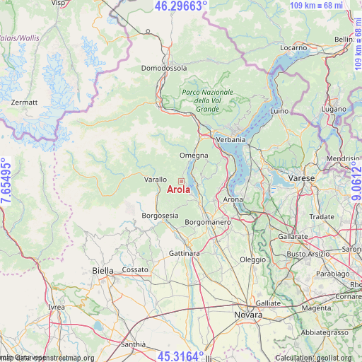
Arola GPS coordinates[2]
45° 48' 31.212" North, 8° 21' 29.088" East
| Map corner | latitude | longitude |
|---|---|---|
| Upper-left | 46.29663°, | 7.65495° |
| Center: | 45.80867°, | 8.35808° |
| Lower-right: | 45.3164°, | 9.0612° |
| Map W x H: | 109×109 km | = 67.7×67.7mi |
| max Lat: | 47.04031° ⇑13.9% North |
| Arola: | 45.80867° |
| min Lat: | ⇓86.1% South 35.50142° |
| min Long | Arola | max Long |
| 6.69888° | 8.35808° | 18.48682° |
| W 10.5%⇐ | ⇒89.5% E |
Elevation
Elevation of Arola is 618 m = 2028 ft, and this is 311.3 m = 1021 ft above average elevation for this country.
| Max E: |
2085 m = 6841 ft | 14.8% |
| Arola | 618 m 2028 ft | |
| Avg. | 306.7 m = 1006 ft | |
Min E: |
-4 m = -13 ft | 85.2% |
See also: Italy elevation on elevation.city.
Geographical zone
Arola is located in North temperate zone (between Tropic of Cancer and the Arctic Circle). Distance of this North polar circle is 2307.7 km =1433.9 mi to North.| Distance of | km | miles | from Arola |
|---|---|---|---|
| North Pole | 4913.6 | 3053.2 | to North |
| Arctic Circle | 2307.7 | 1433.9 | to North |
| Tropic Cancer | 2487.5 | 1545.7 | to South |
| Equator | 5093.4 | 3164.9 | to South |


Nearby cities:
15 places around Arola: (largest is in red/bold)
• Agrano
6.1 km =3.8 mi,  46°
46°
• Ameno
6.7 km =4.2 mi,  109°
109°
• Breia
6.3 km =3.9 mi,  219°
219°
• Cesara
2.9 km =1.8 mi,  15°
15°
• Civiasco
5 km =3.1 mi,  268°
268°
• Madonna del Sasso
2 km =1.2 mi,  154°
154°
• Miasino
5.6 km =3.5 mi,  97°
97°
• Nonio
4.4 km =2.7 mi, 20°
• Orta San Giulio
4.5 km =2.8 mi, 106°
• Pella
2.4 km =1.5 mi,  121°
121°
• Pettenasco
3.9 km =2.4 mi,  76°
76°
• Pogno
6 km =3.7 mi,  159°
159°
• Quarna Sotto
6.7 km =4.2 mi,  3°
3°
• Roccapietra
6.6 km =4.1 mi,  254°
254°
• San Maurizio D'Opaglio
4.9 km =3 mi,  143°
143°
Sources, notices
• [Note1] Compared only with cities in Italy existing in our database
• [Src1] Map data: © OpenStreetMap contributors (CC-BY-SA)
• [Src2] Other city data from geonames.org with taken over terms of usage.
• [Src3] Geographical zone / Annual Mean Temperature by Robert A. Rohde @ Wikipedia
