Altopascio geodata
Altopascio (Tuscany) is a seat of a third-order administrative division; located in Italy in Europe/Rome (GMT+2) time zone. With population of 9,413 people, there are 999 cities with bigger population in this country. Compared to other cities in Italy, 56.8% of cities are located further ↑North; 61.2% of cities are located further →East and 91.5% of cities have higher elevation than Altopascio. Note1


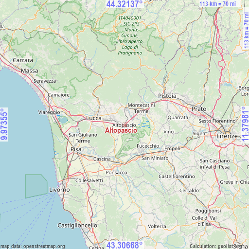
Altopascio GPS coordinates[2]
43° 48' 58.248" North, 10° 40' 36.048" East
| Map corner | latitude | longitude |
|---|---|---|
| Upper-left | 44.32137°, | 9.97355° |
| Center: | 43.81618°, | 10.67668° |
| Lower-right: | 43.30668°, | 11.37981° |
| Map W x H: | 112.8×112.8 km | = 70.1×70.1mi |
| max Lat: | 47.04031° ⇑56.8% North |
| Altopascio: | 43.81618° |
| min Lat: | ⇓43.2% South 35.50142° |
| min Long | Altopascio | max Long |
| 6.69888° | 10.67668° | 18.48682° |
| W 38.8%⇐ | ⇒61.2% E |
Elevation
Elevation of Altopascio is 15 m = 49 ft, and this is 291.7 m = 957 ft below average elevation for this country.
| Max E: |
2085 m = 6841 ft | 91.5% |
| Avg. | 306.7 m = 1006 ft | |
| Altopascio | 15 m = 49 ft | |
Min E: |
-4 m = -13 ft | 8.5% |
See also: Italy elevation on elevation.city.
Geographical zone
Altopascio is located in North temperate zone (between Tropic of Cancer and the Arctic Circle). Distance of this Northern Tropic circle is 2266 km =1408 mi to South.| Distance of | km | miles | from Altopascio |
|---|---|---|---|
| North Pole | 5135.2 | 3190.9 | to North |
| Arctic Circle | 2529.3 | 1571.6 | to North |
| Tropic Cancer | 2266 | 1408 | to South |
| Equator | 4871.9 | 3027.3 | to South |


Nearby cities:
15 places around Altopascio: (largest is in red/bold)
• Anchione
6.7 km =4.2 mi,  80°
80°
• Borgo a Buggiano
8.1 km =5 mi,  35°
35°
• Chiesina Uzzanese
4.3 km =2.7 mi,  54°
54°
• Forone
6.4 km =4 mi,  32°
32°
• Galleno
5.8 km =3.6 mi,  142°
142°
• Marginone
2.7 km =1.7 mi, 25°
• Montecarlo
4.1 km =2.5 mi,  349°
349°
• Orentano
4.4 km =2.7 mi,  198°
198°
• Pescia
7.9 km =4.9 mi,  6°
6°
• Ponte Buggianese
6.6 km =4.1 mi,  59°
59°
• Porcari
5.6 km =3.5 mi,  300°
300°
• San Salvatore
4.1 km =2.5 mi, 9°
• Santa Lucia
7.7 km =4.8 mi,  15°
15°
• Spianate
3.1 km =1.9 mi,  101°
101°
• Villa Campanile
2.9 km =1.8 mi,  161°
161°
Sources, notices
• [Note1] Compared only with cities in Italy existing in our database
• [Src1] Map data: © OpenStreetMap contributors (CC-BY-SA)
• [Src2] Other city data from geonames.org with taken over terms of usage.
• [Src3] Geographical zone / Annual Mean Temperature by Robert A. Rohde @ Wikipedia
