Bordano geodata
Bordano (Friuli Venezia Giulia) is a seat of a third-order administrative division; located in Italy in Europe/Rome (GMT+2) time zone. With population of 602 people, there are 8987 cities with bigger population in this country. Compared to other cities in Italy, 97% of cities are located further ↓South; 69.5% of cities are located further ←West and 52.2% of cities have higher elevation than Bordano. Note1
Administrative division(s):
- Level 1: Friuli Venezia Giulia
- Level 2: Provincia di Udine
- Level 3: Bordano


Bordano GPS coordinates[2]
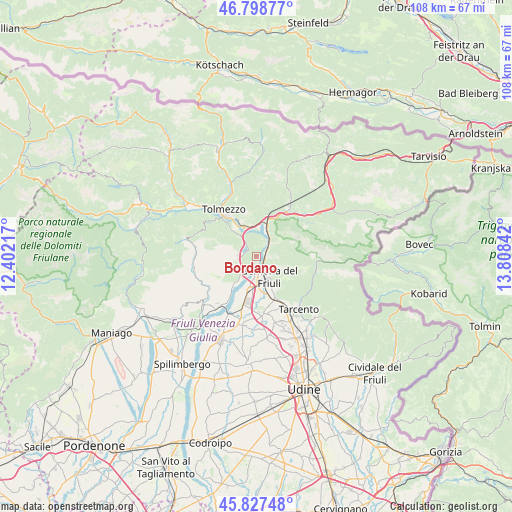
46° 18' 55.008" North, 13° 6' 19.044" East
| Map corner | latitude | longitude |
|---|---|---|
| Upper-left | 46.79877°, | 12.40217° |
| Center: | 46.31528°, | 13.10529° |
| Lower-right: | 45.82748°, | 13.80842° |
| Map W x H: | 108×108 km | = 67.1×67.1mi |
| max Lat: | 47.04031° ⇑3% North |
| Bordano: | 46.31528° |
| min Lat: | ⇓97% South 35.50142° |
| min Long | Bordano | max Long |
| 6.69888° | 13.10529° | 18.48682° |
| W 69.5%⇐ | ⇒30.5% E |
Elevation
Elevation of Bordano is 221 m = 725 ft, and this is 85.7 m = 281 ft below average elevation for this country.
| Max E: |
2085 m = 6841 ft | 52.2% |
| Avg. | 306.7 m = 1006 ft | |
| Bordano | 221 m = 725 ft | |
Min E: |
-4 m = -13 ft | 47.8% |
See also: Italy elevation on elevation.city.
Geographical zone
Bordano is located in North temperate zone (between Tropic of Cancer and the Arctic Circle). Distance of this North polar circle is 2251.4 km =1399 mi to North.| Distance of | km | miles | from Bordano |
|---|---|---|---|
| North Pole | 4857.3 | 3018.2 | to North |
| Arctic Circle | 2251.4 | 1399 | to North |
| Tropic Cancer | 2543.9 | 1580.7 | to South |
| Equator | 5149.8 | 3199.9 | to South |


Nearby cities:
15 places around Bordano: (largest is in red/bold)
• Alesso
4 km =2.5 mi,  271°
271°
• Amaro
6.6 km =4.1 mi,  352°
352°
• Artegna
9.2 km =5.7 mi,  156°
156°
• Buia
11.5 km =7.1 mi,  175°
175°
• Cavazzo Carnico
7.7 km =4.8 mi,  319°
319°
• Chiaulis
12 km =7.5 mi,  313°
313°
• Gemona
4.8 km =3 mi, 164°
• Isola
8.7 km =5.4 mi,  139°
139°
• Moggio di Sotto
12.3 km =7.6 mi,  34°
34°
• Montenars
8.7 km =5.4 mi,  145°
145°
• Osoppo
6.9 km =4.3 mi,  193°
193°
• Santo Stefano
12 km =7.5 mi,  172°
172°
• Tolmezzo
11.4 km =7.1 mi,  325°
325°
• Trasaghis
4.4 km =2.7 mi,  211°
211°
• Venzone
3 km =1.9 mi,  56°
56°
Sources, notices
• [Note1] Compared only with cities in Italy existing in our database
• [Src1] Map data: © OpenStreetMap contributors (CC-BY-SA)
• [Src2] Other city data from geonames.org with taken over terms of usage.
• [Src3] Geographical zone / Annual Mean Temperature by Robert A. Rohde @ Wikipedia
