Preone geodata
Preone (Friuli Venezia Giulia) is a seat of a third-order administrative division; located in Italy in Europe/Rome (GMT+2) time zone. With population of 266 people, there are 10820 cities with bigger population in this country. Compared to other cities in Italy, 97.6% of cities are located further ↓South; 66.8% of cities are located further ←West and 74.5% of cities have lower elevation than Preone. Note1
Administrative division(s):
- Level 1: Friuli Venezia Giulia
- Level 2: Provincia di Udine
- Level 3: Preone


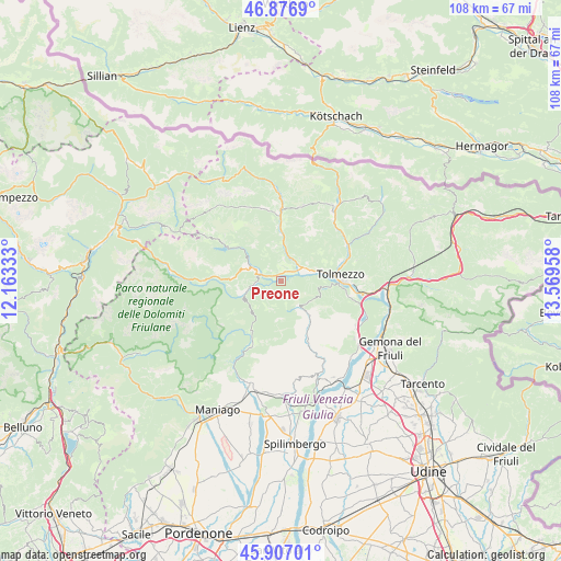
Preone GPS coordinates[2]
46° 23' 38.796" North, 12° 51' 59.22" East
| Map corner | latitude | longitude |
|---|---|---|
| Upper-left | 46.8769°, | 12.16333° |
| Center: | 46.39411°, | 12.86645° |
| Lower-right: | 45.90701°, | 13.56958° |
| Map W x H: | 107.8×107.8 km | = 67×67mi |
| max Lat: | 47.04031° ⇑2.4% North |
| Preone: | 46.39411° |
| min Lat: | ⇓97.6% South 35.50142° |
| min Long | Preone | max Long |
| 6.69888° | 12.86645° | 18.48682° |
| W 66.8%⇐ | ⇒33.2% E |
Elevation
Elevation of Preone is 445 m = 1460 ft, and this is 138.3 m = 454 ft above average elevation for this country.
| Max E: |
2085 m = 6841 ft | 25.5% |
| Preone | 445 m 1460 ft | |
| Avg. | 306.7 m = 1006 ft | |
Min E: |
-4 m = -13 ft | 74.5% |
See also: Italy elevation on elevation.city.
Geographical zone
Preone is located in North temperate zone (between Tropic of Cancer and the Arctic Circle). Distance of this North polar circle is 2242.6 km =1393.5 mi to North.| Distance of | km | miles | from Preone |
|---|---|---|---|
| North Pole | 4848.5 | 3012.7 | to North |
| Arctic Circle | 2242.6 | 1393.5 | to North |
| Tropic Cancer | 2552.6 | 1586.1 | to South |
| Equator | 5158.5 | 3205.3 | to South |


Nearby cities:
15 places around Preone: (largest is in red/bold)
• Ampezzo
5.8 km =3.6 mi,  292°
292°
• Caneva di Tolmezzo
10 km =6.2 mi,  79°
79°
• Cavazzo Carnico
13.7 km =8.5 mi,  102°
102°
• Chiaulis
9.6 km =6 mi,  93°
93°
• Comeglians
13.6 km =8.5 mi,  359°
359°
• Enemonzo-Quinis
1.9 km =1.2 mi,  32°
32°
• Lauco
6 km =3.7 mi,  56°
56°
• Mediis
3.5 km =2.2 mi, 287°
• Ovaro
10 km =6.2 mi,  0°
0°
• Raveo
4.4 km =2.7 mi,  5°
5°
• Tolmezzo
11.8 km =7.3 mi, 86°
• Tramonti di Sopra
11 km =6.8 mi,  212°
212°
• Tramonti di Sotto
13.3 km =8.3 mi,  203°
203°
• Villa Santina
5 km =3.1 mi, 63°
• Zuglio
14.2 km =8.8 mi, 59°
Sources, notices
• [Note1] Compared only with cities in Italy existing in our database
• [Src1] Map data: © OpenStreetMap contributors (CC-BY-SA)
• [Src2] Other city data from geonames.org with taken over terms of usage.
• [Src3] Geographical zone / Annual Mean Temperature by Robert A. Rohde @ Wikipedia
