Zuclo geodata
Zuclo (Trentino-Alto Adige) is a seat of a third-order administrative division; located in Italy in Europe/Rome (GMT+2) time zone. With population of 326 people, there are 10569 cities with bigger population in this country. Compared to other cities in Italy, 92.7% of cities are located further ↓South; 60.3% of cities are located further →East and 84.2% of cities have lower elevation than Zuclo. Note1
Administrative division(s):
- Level 1: Trentino-Alto Adige
- Level 2: Provincia autonoma di Trento
- Level 3: Borgo Lares


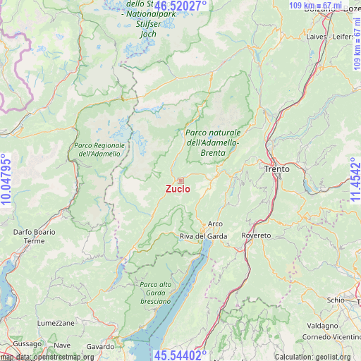
Zuclo GPS coordinates[2]
46° 2' 3.48" North, 10° 45' 3.852" East
| Map corner | latitude | longitude |
|---|---|---|
| Upper-left | 46.52027°, | 10.04795° |
| Center: | 46.0343°, | 10.75107° |
| Lower-right: | 45.54402°, | 11.4542° |
| Map W x H: | 108.5×108.5 km | = 67.4×67.4mi |
| max Lat: | 47.04031° ⇑7.3% North |
| Zuclo: | 46.0343° |
| min Lat: | ⇓92.7% South 35.50142° |
| min Long | Zuclo | max Long |
| 6.69888° | 10.75107° | 18.48682° |
| W 39.7%⇐ | ⇒60.3% E |
Elevation
Elevation of Zuclo is 596 m = 1955 ft, and this is 289.3 m = 949 ft above average elevation for this country.
| Max E: |
2085 m = 6841 ft | 15.8% |
| Zuclo | 596 m 1955 ft | |
| Avg. | 306.7 m = 1006 ft | |
Min E: |
-4 m = -13 ft | 84.2% |
See also: Italy elevation on elevation.city.
Geographical zone
Zuclo is located in North temperate zone (between Tropic of Cancer and the Arctic Circle). Distance of this North polar circle is 2282.6 km =1418.3 mi to North.| Distance of | km | miles | from Zuclo |
|---|---|---|---|
| North Pole | 4888.5 | 3037.6 | to North |
| Arctic Circle | 2282.6 | 1418.3 | to North |
| Tropic Cancer | 2512.6 | 1561.3 | to South |
| Equator | 5118.5 | 3180.5 | to South |


Nearby cities:
15 places around Zuclo: (largest is in red/bold)
• Bleggio Superiore
6.8 km =4.2 mi,  98°
98°
• Bolbeno
1 km =0.6 mi,  259°
259°
• Bondo
5.9 km =3.7 mi,  230°
230°
• Breguzzo
5.1 km =3.2 mi, 233°
• Fiavè
7.8 km =4.8 mi,  115°
115°
• Montagne
2.7 km =1.7 mi,  0°
0°
• Pelugo
6.4 km =4 mi,  340°
340°
• Preore
1.5 km =0.9 mi,  25°
25°
• Ragoli
3.1 km =1.9 mi,  43°
43°
• Roncone
8.6 km =5.3 mi, 228°
• Spiazzo
7.8 km =4.8 mi,  353°
353°
• Stenico
8.3 km =5.2 mi,  76°
76°
• Tione di Trento
1.9 km =1.2 mi,  274°
274°
• Vigo Rendena
5.6 km =3.5 mi, 335°
• Villa Rendena
4.3 km =2.7 mi,  316°
316°
Sources, notices
• [Note1] Compared only with cities in Italy existing in our database
• [Src1] Map data: © OpenStreetMap contributors (CC-BY-SA)
• [Src2] Other city data from geonames.org with taken over terms of usage.
• [Src3] Geographical zone / Annual Mean Temperature by Robert A. Rohde @ Wikipedia
