Valtournenche geodata
Valtournenche (Aosta Valley) is a seat of a third-order administrative division; located in Italy in Europe/Rome (GMT+2) time zone. With population of 2,198 people, there are 3875 cities with bigger population in this country. Compared to other cities in Italy, 88.5% of cities are located further ↓South; 96.9% of cities are located further →East and 99.7% of cities have lower elevation than Valtournenche. Note1


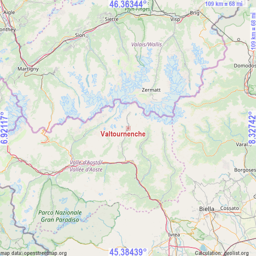
Valtournenche GPS coordinates[2]
45° 52' 33.852" North, 7° 37' 27.48" East
| Map corner | latitude | longitude |
|---|---|---|
| Upper-left | 46.36344°, | 6.92117° |
| Center: | 45.87607°, | 7.6243° |
| Lower-right: | 45.38439°, | 8.32742° |
| Map W x H: | 108.9×108.9 km | = 67.7×67.7mi |
| max Lat: | 47.04031° ⇑11.5% North |
| Valtournenche: | 45.87607° |
| min Lat: | ⇓88.5% South 35.50142° |
| min Long | Valtournenche | max Long |
| 6.69888° | 7.6243° | 18.48682° |
| W 3.1%⇐ | ⇒96.9% E |
Elevation
Elevation of Valtournenche is 1518 m = 4980 ft, and this is 1211.3 m = 3974 ft above average elevation for this country.
| Max E: |
2085 m = 6841 ft | 0.3% |
| Valtournenche | 1518 m 4980 ft | |
| Avg. | 306.7 m = 1006 ft | |
Min E: |
-4 m = -13 ft | 99.7% |
See also: Italy elevation on elevation.city.
Geographical zone
Valtournenche is located in North temperate zone (between Tropic of Cancer and the Arctic Circle). Distance of this North polar circle is 2300.2 km =1429.3 mi to North.| Distance of | km | miles | from Valtournenche |
|---|---|---|---|
| North Pole | 4906.1 | 3048.5 | to North |
| Arctic Circle | 2300.2 | 1429.3 | to North |
| Tropic Cancer | 2495 | 1550.3 | to South |
| Equator | 5100.9 | 3169.6 | to South |


Nearby cities:
15 places around Valtournenche: (largest is in red/bold)
• Antagnod
8.5 km =5.3 mi,  143°
143°
• Antey-Saint-Andrè
8.3 km =5.2 mi,  200°
200°
• Ayas
8.4 km =5.2 mi, 143°
• Breuil-Cervinia
6.5 km =4 mi,  5°
5°
• Brusson
15.3 km =9.5 mi,  148°
148°
• Chamois
4.2 km =2.6 mi,  185°
185°
• Chatillon
14 km =8.7 mi,  182°
182°
• La Magdeleine
7.4 km =4.6 mi, 183°
• Mongnod
9 km =5.6 mi,  209°
209°
• Paquier
0.3 km =0.2 mi,  20°
20°
• Pontey
15.5 km =9.6 mi, 190°
• Saint-Denis
14.7 km =9.1 mi, 201°
• Saint-Vincent
14 km =8.7 mi,  172°
172°
• Torgnon
8.8 km =5.5 mi, 208°
• Verrayes
14.3 km =8.9 mi, 208°
Sources, notices
• [Note1] Compared only with cities in Italy existing in our database
• [Src1] Map data: © OpenStreetMap contributors (CC-BY-SA)
• [Src2] Other city data from geonames.org with taken over terms of usage.
• [Src3] Geographical zone / Annual Mean Temperature by Robert A. Rohde @ Wikipedia
