Fiumara geodata
Fiumara (Calabria) is a seat of a third-order administrative division; located in Italy in Europe/Rome (GMT+2) time zone. With population of 1,201 people, there are 5953 cities with bigger population in this country. Compared to other cities in Italy, 94.9% of cities are located further ↑North; 91.3% of cities are located further ←West and 58.2% of cities have higher elevation than Fiumara. Note1
Administrative division(s):
- Level 1: Calabria
- Level 2: Provincia di Reggio Calabria
- Level 3: Fiumara


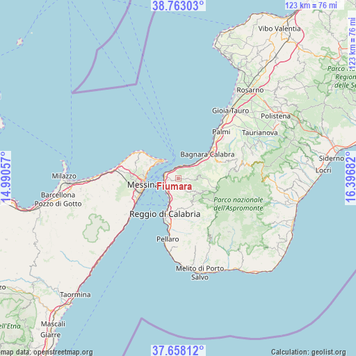
Fiumara GPS coordinates[2]
38° 12' 45.612" North, 15° 41' 37.284" East
| Map corner | latitude | longitude |
|---|---|---|
| Upper-left | 38.76303°, | 14.99057° |
| Center: | 38.21267°, | 15.69369° |
| Lower-right: | 37.65812°, | 16.39682° |
| Map W x H: | 122.9×122.9 km | = 76.4×76.4mi |
| max Lat: | 47.04031° ⇑94.9% North |
| Fiumara: | 38.21267° |
| min Lat: | ⇓5.1% South 35.50142° |
| min Long | Fiumara | max Long |
| 6.69888° | 15.69369° | 18.48682° |
| W 91.3%⇐ | ⇒8.7% E |
Elevation
Elevation of Fiumara is 178 m = 584 ft, and this is 128.7 m = 422 ft below average elevation for this country.
| Max E: |
2085 m = 6841 ft | 58.2% |
| Avg. | 306.7 m = 1006 ft | |
| Fiumara | 178 m = 584 ft | |
Min E: |
-4 m = -13 ft | 41.8% |
See also: Italy elevation on elevation.city.
Geographical zone
Fiumara is located in North temperate zone (between Tropic of Cancer and the Arctic Circle). Distance of this Northern Tropic circle is 1642.9 km =1020.9 mi to South.| Distance of | km | miles | from Fiumara |
|---|---|---|---|
| North Pole | 5758.2 | 3578 | to North |
| Arctic Circle | 3152.3 | 1958.7 | to North |
| Tropic Cancer | 1642.9 | 1020.9 | to South |
| Equator | 4248.9 | 2640.1 | to South |


Nearby cities:
15 places around Fiumara: (largest is in red/bold)
• Calanna
4 km =2.5 mi,  140°
140°
• Campo Calabro
3 km =1.9 mi,  277°
277°
• Colelli
2.5 km =1.6 mi,  92°
92°
• Faro Superiore
11.5 km =7.1 mi,  302°
302°
• Laganadi
6 km =3.7 mi, 135°
• Sambatello
3.8 km =2.4 mi,  181°
181°
• San Nicola
0.1 km =0.1 mi,  172°
172°
• San Roberto
3.7 km =2.3 mi, 92°
• Sant'Alessio in Aspromonte
7.2 km =4.5 mi,  128°
128°
• Santo Stefano in Aspromonte
9.7 km =6 mi,  119°
119°
• Scilla
4.9 km =3 mi,  26°
26°
• Solano Inferiore
10.5 km =6.5 mi,  61°
61°
• Solano Superiore
10.2 km =6.3 mi, 64°
• Terreti
10.3 km =6.4 mi, 171°
• Villa San Giovanni
5 km =3.1 mi, 279°
Sources, notices
• [Note1] Compared only with cities in Italy existing in our database
• [Src1] Map data: © OpenStreetMap contributors (CC-BY-SA)
• [Src2] Other city data from geonames.org with taken over terms of usage.
• [Src3] Geographical zone / Annual Mean Temperature by Robert A. Rohde @ Wikipedia
