Roghudi geodata
Roghudi (Calabria) is a seat of a third-order administrative division; located in Italy in Europe/Rome (GMT+2) time zone. With population of 1,066 people, there are 6417 cities with bigger population in this country. Compared to other cities in Italy, 97.2% of cities are located further ↑North; 91.6% of cities are located further ←West and 81.7% of cities have higher elevation than Roghudi. Note1
Administrative division(s):
- Level 1: Calabria
- Level 2: Provincia di Reggio Calabria
- Level 3: Roghudi


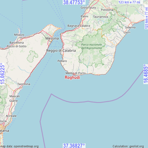
Roghudi GPS coordinates[2]
37° 55' 29.964" North, 15° 45' 55.332" East
| Map corner | latitude | longitude |
|---|---|---|
| Upper-left | 38.47753°, | 15.06225° |
| Center: | 37.92499°, | 15.76537° |
| Lower-right: | 37.36827°, | 16.4685° |
| Map W x H: | 123.3×123.3 km | = 76.6×76.6mi |
| max Lat: | 47.04031° ⇑97.2% North |
| Roghudi: | 37.92499° |
| min Lat: | ⇓2.8% South 35.50142° |
| min Long | Roghudi | max Long |
| 6.69888° | 15.76537° | 18.48682° |
| W 91.6%⇐ | ⇒8.4% E |
Elevation
Elevation of Roghudi is 43 m = 141 ft, and this is 263.7 m = 865 ft below average elevation for this country.
| Max E: |
2085 m = 6841 ft | 81.7% |
| Avg. | 306.7 m = 1006 ft | |
| Roghudi | 43 m = 141 ft | |
Min E: |
-4 m = -13 ft | 18.3% |
See also: Italy elevation on elevation.city.
Geographical zone
Roghudi is located in North temperate zone (between Tropic of Cancer and the Arctic Circle). Distance of this Northern Tropic circle is 1610.9 km =1001 mi to South.| Distance of | km | miles | from Roghudi |
|---|---|---|---|
| North Pole | 5790.2 | 3597.9 | to North |
| Arctic Circle | 3184.3 | 1978.6 | to North |
| Tropic Cancer | 1610.9 | 1001 | to South |
| Equator | 4216.9 | 2620.3 | to South |


Nearby cities:
15 places around Roghudi: (largest is in red/bold)
• Caredia-Lacco
4.4 km =2.7 mi,  38°
38°
• Chorio
8 km =5 mi,  31°
31°
• Condofuri
12 km =7.5 mi, 42°
• Fossato Ionico-Fossatello-San Luca Marcelluzzo
9.5 km =5.9 mi,  358°
358°
• Lazzaro
10.3 km =6.4 mi,  301°
301°
• Marina di San Lorenzo
5.8 km =3.6 mi,  94°
94°
• Masella
4.6 km =2.9 mi,  347°
347°
• Melito di Porto Salvo
1.4 km =0.9 mi,  276°
276°
• Montebello Jonico
6.5 km =4 mi, 354°
• Motta San Giovanni
10.5 km =6.5 mi,  334°
334°
• Prunella
3.1 km =1.9 mi,  56°
56°
• Saline Ioniche
4.3 km =2.7 mi,  291°
291°
• San Carlo-Condofuri Marina
9.4 km =5.8 mi,  84°
84°
• San Lorenzo
11.3 km =7 mi, 32°
• San Pantaleone
9.8 km =6.1 mi, 43°
Sources, notices
• [Note1] Compared only with cities in Italy existing in our database
• [Src1] Map data: © OpenStreetMap contributors (CC-BY-SA)
• [Src2] Other city data from geonames.org with taken over terms of usage.
• [Src3] Geographical zone / Annual Mean Temperature by Robert A. Rohde @ Wikipedia
