Vallanzengo geodata
Vallanzengo (Piedmont) is a seat of a third-order administrative division; located in Italy in Europe/Rome (GMT+2) time zone. With population of 250 people, there are 10893 cities with bigger population in this country. Compared to other cities in Italy, 77.2% of cities are located further ↓South; 91.6% of cities are located further →East and 72.1% of cities have lower elevation than Vallanzengo. Note1


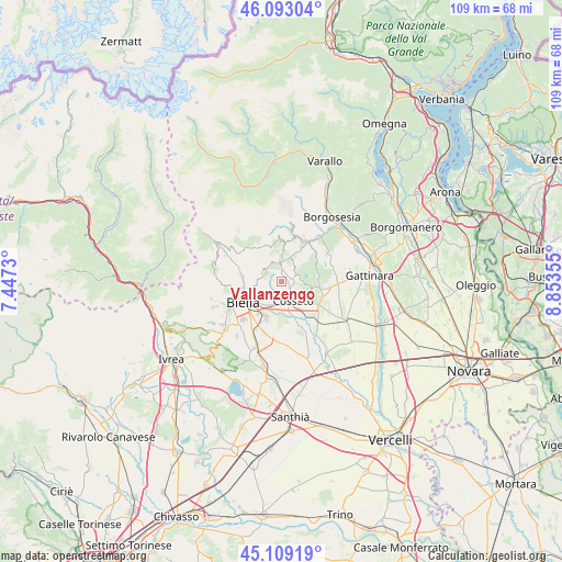
Vallanzengo GPS coordinates[2]
45° 36' 11.772" North, 8° 9' 1.512" East
| Map corner | latitude | longitude |
|---|---|---|
| Upper-left | 46.09304°, | 7.4473° |
| Center: | 45.60327°, | 8.15042° |
| Lower-right: | 45.10919°, | 8.85355° |
| Map W x H: | 109.4×109.4 km | = 68×68mi |
| max Lat: | 47.04031° ⇑22.8% North |
| Vallanzengo: | 45.60327° |
| min Lat: | ⇓77.2% South 35.50142° |
| min Long | Vallanzengo | max Long |
| 6.69888° | 8.15042° | 18.48682° |
| W 8.4%⇐ | ⇒91.6% E |
Elevation
Elevation of Vallanzengo is 416 m = 1365 ft, and this is 109.3 m = 359 ft above average elevation for this country.
| Max E: |
2085 m = 6841 ft | 27.9% |
| Vallanzengo | 416 m 1365 ft | |
| Avg. | 306.7 m = 1006 ft | |
Min E: |
-4 m = -13 ft | 72.1% |
See also: Italy elevation on elevation.city.
Geographical zone
Vallanzengo is located in North temperate zone (between Tropic of Cancer and the Arctic Circle). Distance of this North polar circle is 2330.6 km =1448.2 mi to North.| Distance of | km | miles | from Vallanzengo |
|---|---|---|---|
| North Pole | 4936.5 | 3067.4 | to North |
| Arctic Circle | 2330.6 | 1448.2 | to North |
| Tropic Cancer | 2464.7 | 1531.5 | to South |
| Equator | 5070.6 | 3150.7 | to South |


Nearby cities:
15 places around Vallanzengo: (largest is in red/bold)
• Bioglio-Portula-Andrè
1.7 km =1.1 mi,  319°
319°
• Capovilla-Castello
3.7 km =2.3 mi,  104°
104°
• Casapinta
3.8 km =2.4 mi,  68°
68°
• Fontanella-Ozino
2.3 km =1.4 mi,  38°
38°
• Lessona
3.9 km =2.4 mi,  118°
118°
• Livera
3.6 km =2.2 mi,  286°
286°
• Maglione-Crosa
0.1 km =0.1 mi,  247°
247°
• Mezzana Mortigliengo
4 km =2.5 mi,  49°
49°
• Pettinengo
3.8 km =2.4 mi, 286°
• Piatto
1.9 km =1.2 mi,  218°
218°
• Quaregna
2.7 km =1.7 mi,  157°
157°
• Ternengo
3.3 km =2.1 mi,  240°
240°
• Valdengo
4.1 km =2.5 mi,  193°
193°
• Valle Mosso
3.1 km =1.9 mi,  355°
355°
• Valle San Nicolao
0.8 km =0.5 mi,  299°
299°
Sources, notices
• [Note1] Compared only with cities in Italy existing in our database
• [Src1] Map data: © OpenStreetMap contributors (CC-BY-SA)
• [Src2] Other city data from geonames.org with taken over terms of usage.
• [Src3] Geographical zone / Annual Mean Temperature by Robert A. Rohde @ Wikipedia
