Solonghello geodata
Solonghello (Piedmont) is a seat of a third-order administrative division; located in Italy in Europe/Rome (GMT+2) time zone. With population of 88 people, there are 11484 cities with bigger population in this country. Compared to other cities in Italy, 63.2% of cities are located further ↓South; 90.3% of cities are located further →East and 57.7% of cities have higher elevation than Solonghello. Note1
Administrative division(s):
- Level 1: Piedmont
- Level 2: Provincia di Alessandria
- Level 3: Solonghello


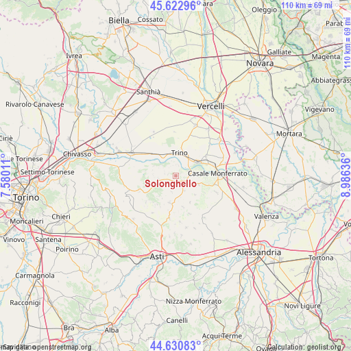
Solonghello GPS coordinates[2]
45° 7' 44.58" North, 8° 16' 59.628" East
| Map corner | latitude | longitude |
|---|---|---|
| Upper-left | 45.62296°, | 7.58011° |
| Center: | 45.12905°, | 8.28323° |
| Lower-right: | 44.63083°, | 8.98636° |
| Map W x H: | 110.3×110.3 km | = 68.5×68.5mi |
| max Lat: | 47.04031° ⇑36.8% North |
| Solonghello: | 45.12905° |
| min Lat: | ⇓63.2% South 35.50142° |
| min Long | Solonghello | max Long |
| 6.69888° | 8.28323° | 18.48682° |
| W 9.7%⇐ | ⇒90.3% E |
Elevation
Elevation of Solonghello is 182 m = 597 ft, and this is 124.7 m = 409 ft below average elevation for this country.
| Max E: |
2085 m = 6841 ft | 57.7% |
| Avg. | 306.7 m = 1006 ft | |
| Solonghello | 182 m = 597 ft | |
Min E: |
-4 m = -13 ft | 42.3% |
See also: Italy elevation on elevation.city.
Geographical zone
Solonghello is located in North temperate zone (between Tropic of Cancer and the Arctic Circle). Distance of this North polar circle is 2383.3 km =1480.9 mi to North.| Distance of | km | miles | from Solonghello |
|---|---|---|---|
| North Pole | 4989.2 | 3100.1 | to North |
| Arctic Circle | 2383.3 | 1480.9 | to North |
| Tropic Cancer | 2412 | 1498.7 | to South |
| Equator | 5017.9 | 3118 | to South |


Nearby cities:
15 places around Solonghello: (largest is in red/bold)
• Camino
3.2 km =2 mi,  14°
14°
• Castelletto Merli
7 km =4.3 mi,  208°
208°
• Cereseto
5.4 km =3.4 mi,  149°
149°
• Cerrina
5.5 km =3.4 mi,  261°
261°
• Coniolo Bricco
7.2 km =4.5 mi,  72°
72°
• Gabiano
7.6 km =4.7 mi,  294°
294°
• Mombello Monferrato
2.6 km =1.6 mi,  279°
279°
• Ozzano Monferrato
7.5 km =4.7 mi,  110°
110°
• Palazzolo Vercellese
7.4 km =4.6 mi,  327°
327°
• Pontestura
4.2 km =2.6 mi, 69°
• Ponzano Monferrato
5.1 km =3.2 mi,  195°
195°
• Serralunga di Crea
3.1 km =1.9 mi,  183°
183°
• Treville
7 km =4.3 mi,  120°
120°
• Trino
7.4 km =4.6 mi, 7°
• Valle Cerrina
5.8 km =3.6 mi,  254°
254°
Sources, notices
• [Note1] Compared only with cities in Italy existing in our database
• [Src1] Map data: © OpenStreetMap contributors (CC-BY-SA)
• [Src2] Other city data from geonames.org with taken over terms of usage.
• [Src3] Geographical zone / Annual Mean Temperature by Robert A. Rohde @ Wikipedia
