Lazzate geodata
Lazzate (Lombardy) is a seat of a third-order administrative division; located in Italy in Europe/Rome (GMT+2) time zone. With population of 7,560 people, there are 1290 cities with bigger population in this country. Compared to other cities in Italy, 79.9% of cities are located further ↓South; 79.9% of cities are located further →East and 53.9% of cities have lower elevation than Lazzate. Note1
Administrative division(s):
- Level 1: Lombardy
- Level 2: Provincia di Monza e della Brianza
- Level 3: Lazzate


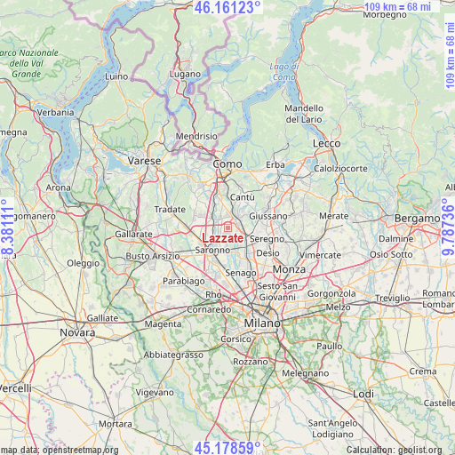
Lazzate GPS coordinates[2]
45° 40' 19.452" North, 9° 5' 3.264" East
| Map corner | latitude | longitude |
|---|---|---|
| Upper-left | 46.16123°, | 8.38111° |
| Center: | 45.67207°, | 9.08424° |
| Lower-right: | 45.17859°, | 9.78736° |
| Map W x H: | 109.3×109.3 km | = 67.9×67.9mi |
| max Lat: | 47.04031° ⇑20.1% North |
| Lazzate: | 45.67207° |
| min Lat: | ⇓79.9% South 35.50142° |
| min Long | Lazzate | max Long |
| 6.69888° | 9.08424° | 18.48682° |
| W 20.1%⇐ | ⇒79.9% E |
Elevation
Elevation of Lazzate is 259 m = 850 ft, and this is 47.7 m = 156 ft below average elevation for this country.
| Max E: |
2085 m = 6841 ft | 46.1% |
| Avg. | 306.7 m = 1006 ft | |
| Lazzate | 259 m = 850 ft | |
Min E: |
-4 m = -13 ft | 53.9% |
See also: Italy elevation on elevation.city.
Geographical zone
Lazzate is located in North temperate zone (between Tropic of Cancer and the Arctic Circle). Distance of this North polar circle is 2322.9 km =1443.4 mi to North.| Distance of | km | miles | from Lazzate |
|---|---|---|---|
| North Pole | 4928.8 | 3062.6 | to North |
| Arctic Circle | 2322.9 | 1443.4 | to North |
| Tropic Cancer | 2472.3 | 1536.2 | to South |
| Equator | 5078.3 | 3155.5 | to South |


Nearby cities:
15 places around Lazzate: (largest is in red/bold)
• Barlassina
3.9 km =2.4 mi,  117°
117°
• Bregnano
3.5 km =2.2 mi,  325°
325°
• Carimate
4.2 km =2.6 mi,  25°
25°
• Cascina Nuova
2.6 km =1.6 mi,  215°
215°
• Cascina Valle-Stazione di Carimate
3.3 km =2.1 mi,  39°
39°
• Cermenate
3.3 km =2.1 mi,  359°
359°
• Cimnago
3.9 km =2.4 mi,  61°
61°
• Cogliate
2.9 km =1.8 mi,  188°
188°
• Lentate sul Seveso
2.6 km =1.6 mi,  79°
79°
• Manera
3.4 km =2.1 mi,  272°
272°
• Misinto
1.2 km =0.7 mi, 190°
• Novedrate
4 km =2.5 mi, 44°
• Rovellasca
2.8 km =1.7 mi,  257°
257°
• Rovello Porro
4.1 km =2.5 mi,  237°
237°
• San Michele-San Giorgio
3.3 km =2.1 mi,  323°
323°
Sources, notices
• [Note1] Compared only with cities in Italy existing in our database
• [Src1] Map data: © OpenStreetMap contributors (CC-BY-SA)
• [Src2] Other city data from geonames.org with taken over terms of usage.
• [Src3] Geographical zone / Annual Mean Temperature by Robert A. Rohde @ Wikipedia
