Motteggiana geodata
Motteggiana (Lombardy) is a seat of a third-order administrative division; located in Italy in Europe/Rome (GMT+2) time zone. With population of 767 people, there are 7836 cities with bigger population in this country. Compared to other cities in Italy, 60.8% of cities are located further ↓South; 60.1% of cities are located further →East and 90.1% of cities have higher elevation than Motteggiana. Note1


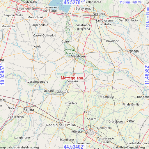
Motteggiana GPS coordinates[2]
45° 1' 59.052" North, 10° 45' 45.684" East
| Map corner | latitude | longitude |
|---|---|---|
| Upper-left | 45.52781°, | 10.05957° |
| Center: | 45.03307°, | 10.76269° |
| Lower-right: | 44.53402°, | 11.46582° |
| Map W x H: | 110.5×110.5 km | = 68.7×68.7mi |
| max Lat: | 47.04031° ⇑39.2% North |
| Motteggiana: | 45.03307° |
| min Lat: | ⇓60.8% South 35.50142° |
| min Long | Motteggiana | max Long |
| 6.69888° | 10.76269° | 18.48682° |
| W 39.9%⇐ | ⇒60.1% E |
Elevation
Elevation of Motteggiana is 18 m = 59 ft, and this is 288.7 m = 947 ft below average elevation for this country.
| Max E: |
2085 m = 6841 ft | 90.1% |
| Avg. | 306.7 m = 1006 ft | |
| Motteggiana | 18 m = 59 ft | |
Min E: |
-4 m = -13 ft | 9.9% |
See also: Italy elevation on elevation.city.
Geographical zone
Motteggiana is located in North temperate zone (between Tropic of Cancer and the Arctic Circle). Distance of this North polar circle is 2394 km =1487.6 mi to North.| Distance of | km | miles | from Motteggiana |
|---|---|---|---|
| North Pole | 4999.9 | 3106.8 | to North |
| Arctic Circle | 2394 | 1487.6 | to North |
| Tropic Cancer | 2401.3 | 1492.1 | to South |
| Equator | 5007.2 | 3111.3 | to South |


Nearby cities:
15 places around Motteggiana: (largest is in red/bold)
• Borgoforte
2.3 km =1.4 mi,  334°
334°
• Buscoldo
8.6 km =5.3 mi,  322°
322°
• Cappelletta
8.1 km =5 mi,  8°
8°
• Cerese
9.7 km =6 mi, 12°
• Cizzolo
8.1 km =5 mi,  251°
251°
• Codisotto
6.2 km =3.9 mi,  206°
206°
• Palidano
6.9 km =4.3 mi,  169°
169°
• Pegognaga
8.7 km =5.4 mi,  119°
119°
• Polesine
6.2 km =3.9 mi,  148°
148°
• Romanore
3.8 km =2.4 mi,  353°
353°
• San Biagio
9.9 km =6.2 mi,  42°
42°
• San Cataldo
4.5 km =2.8 mi,  20°
20°
• Suzzara
4.8 km =3 mi,  197°
197°
• Tabellano
3.7 km =2.3 mi,  242°
242°
• Villa Saviola
2.9 km =1.8 mi,  96°
96°
Sources, notices
• [Note1] Compared only with cities in Italy existing in our database
• [Src1] Map data: © OpenStreetMap contributors (CC-BY-SA)
• [Src2] Other city data from geonames.org with taken over terms of usage.
• [Src3] Geographical zone / Annual Mean Temperature by Robert A. Rohde @ Wikipedia
