Giustino geodata
Giustino (Trentino-Alto Adige) is a seat of a third-order administrative division; located in Italy in Europe/Rome (GMT+2) time zone. With population of 734 people, there are 8058 cities with bigger population in this country. Compared to other cities in Italy, 95% of cities are located further ↓South; 60.1% of cities are located further →East and 92.1% of cities have lower elevation than Giustino. Note1
Administrative division(s):
- Level 1: Trentino-Alto Adige
- Level 2: Provincia autonoma di Trento
- Level 3: Giustino


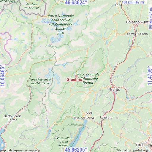
Giustino GPS coordinates[2]
46° 9' 4.68" North, 10° 46' 3.972" East
| Map corner | latitude | longitude |
|---|---|---|
| Upper-left | 46.63624°, | 10.06465° |
| Center: | 46.1513°, | 10.76777° |
| Lower-right: | 45.66205°, | 11.4709° |
| Map W x H: | 108.3×108.3 km | = 67.3×67.3mi |
| max Lat: | 47.04031° ⇑5% North |
| Giustino: | 46.1513° |
| min Lat: | ⇓95% South 35.50142° |
| min Long | Giustino | max Long |
| 6.69888° | 10.76777° | 18.48682° |
| W 39.9%⇐ | ⇒60.1% E |
Elevation
Elevation of Giustino is 773 m = 2536 ft, and this is 466.3 m = 1530 ft above average elevation for this country.
| Max E: |
2085 m = 6841 ft | 7.9% |
| Giustino | 773 m 2536 ft | |
| Avg. | 306.7 m = 1006 ft | |
Min E: |
-4 m = -13 ft | 92.1% |
See also: Italy elevation on elevation.city.
Geographical zone
Giustino is located in North temperate zone (between Tropic of Cancer and the Arctic Circle). Distance of this North polar circle is 2269.6 km =1410.3 mi to North.| Distance of | km | miles | from Giustino |
|---|---|---|---|
| North Pole | 4875.5 | 3029.5 | to North |
| Arctic Circle | 2269.6 | 1410.3 | to North |
| Tropic Cancer | 2525.6 | 1569.3 | to South |
| Equator | 5131.5 | 3188.6 | to South |


Nearby cities:
15 places around Giustino: (largest is in red/bold)
• Bocenago
3.7 km =2.3 mi,  190°
190°
• Caderzone Terme
2.6 km =1.6 mi,  200°
200°
• Carisolo
2.1 km =1.3 mi,  340°
340°
• Madonna di Campiglio
9.5 km =5.9 mi,  28°
28°
• Massimeno
1.2 km =0.7 mi,  160°
160°
• Montagne
10.4 km =6.5 mi, 187°
• Pelugo
7.8 km =4.8 mi,  205°
205°
• Pinzolo
1 km =0.6 mi, 341°
• Preore
11.7 km =7.3 mi,  183°
183°
• Ragoli
10.8 km =6.7 mi, 175°
• Spiazzo
5.7 km =3.5 mi, 202°
• Stenico
13 km =8.1 mi,  148°
148°
• Strembo
3.7 km =2.3 mi, 200°
• Vigo Rendena
8.7 km =5.4 mi, 204°
• Villa Rendena
10.7 km =6.6 mi, 203°
Sources, notices
• [Note1] Compared only with cities in Italy existing in our database
• [Src1] Map data: © OpenStreetMap contributors (CC-BY-SA)
• [Src2] Other city data from geonames.org with taken over terms of usage.
• [Src3] Geographical zone / Annual Mean Temperature by Robert A. Rohde @ Wikipedia
