Frescada geodata
Frescada (Veneto) is a populated place; located in Italy in Europe/Rome (GMT+2) time zone. With population of 5,800 people, there are 1689 cities with bigger population in this country. Compared to other cities in Italy, 78.2% of cities are located further ↓South; 59.1% of cities are located further ←West and 92.6% of cities have higher elevation than Frescada. Note1


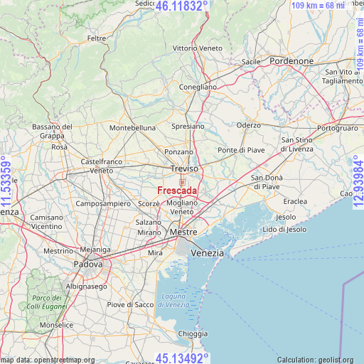
Frescada GPS coordinates[2]
45° 37' 43.608" North, 12° 14' 12.156" East
| Map corner | latitude | longitude |
|---|---|---|
| Upper-left | 46.11832°, | 11.53359° |
| Center: | 45.62878°, | 12.23671° |
| Lower-right: | 45.13492°, | 12.93984° |
| Map W x H: | 109.3×109.3 km | = 67.9×67.9mi |
| max Lat: | 47.04031° ⇑21.8% North |
| Frescada: | 45.62878° |
| min Lat: | ⇓78.2% South 35.50142° |
| min Long | Frescada | max Long |
| 6.69888° | 12.23671° | 18.48682° |
| W 59.1%⇐ | ⇒40.9% E |
Elevation
Elevation of Frescada is 13 m = 43 ft, and this is 293.7 m = 964 ft below average elevation for this country.
| Max E: |
2085 m = 6841 ft | 92.6% |
| Avg. | 306.7 m = 1006 ft | |
| Frescada | 13 m = 43 ft | |
Min E: |
-4 m = -13 ft | 7.4% |
See also: Italy elevation on elevation.city.
Geographical zone
Frescada is located in North temperate zone (between Tropic of Cancer and the Arctic Circle). Distance of this North polar circle is 2327.7 km =1446.4 mi to North.| Distance of | km | miles | from Frescada |
|---|---|---|---|
| North Pole | 4933.6 | 3065.6 | to North |
| Arctic Circle | 2327.7 | 1446.4 | to North |
| Tropic Cancer | 2467.5 | 1533.2 | to South |
| Equator | 5073.4 | 3152.5 | to South |


Nearby cities:
15 places around Frescada: (largest is in red/bold)
• Borgo Verde
3.6 km =2.2 mi,  150°
150°
• Campocroce
5.1 km =3.2 mi,  197°
197°
• Casier
4.6 km =2.9 mi,  71°
71°
• Cendon
6.9 km =4.3 mi,  81°
81°
• Conscio
3.8 km =2.4 mi,  110°
110°
• Dosson
1.6 km =1 mi,  59°
59°
• Lughignano
6.9 km =4.3 mi,  93°
93°
• Paese
7.6 km =4.7 mi,  311°
311°
• Preganziol
3 km =1.9 mi,  179°
179°
• Quinto di Treviso
5.8 km =3.6 mi,  286°
286°
• Sambughe
4.1 km =2.5 mi, 200°
• Silea
5.5 km =3.4 mi, 58°
• Treviso
4.2 km =2.6 mi,  5°
5°
• Zerman
6.1 km =3.8 mi,  156°
156°
• Zero Branco
6.5 km =4 mi,  240°
240°
Sources, notices
• [Note1] Compared only with cities in Italy existing in our database
• [Src1] Map data: © OpenStreetMap contributors (CC-BY-SA)
• [Src2] Other city data from geonames.org with taken over terms of usage.
• [Src3] Geographical zone / Annual Mean Temperature by Robert A. Rohde @ Wikipedia
