Settimo geodata
Settimo (Calabria) is a populated place; located in Italy in Europe/Rome (GMT+2) time zone. With population of 2,611 people, there are 3404 cities with bigger population in this country. Compared to other cities in Italy, 90.8% of cities are located further ↑North; 94.7% of cities are located further ←West and 59% of cities have higher elevation than Settimo. Note1
Administrative division(s):
- Level 1: Calabria
- Level 2: Provincia di Cosenza
- Level 3: Montalto Uffugo


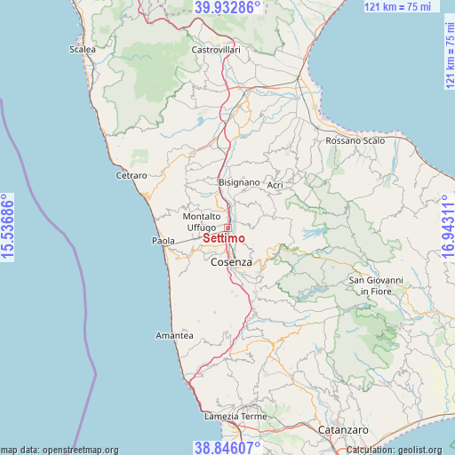
Settimo GPS coordinates[2]
39° 23' 29.688" North, 16° 14' 23.928" East
| Map corner | latitude | longitude |
|---|---|---|
| Upper-left | 39.93286°, | 15.53686° |
| Center: | 39.39158°, | 16.23998° |
| Lower-right: | 38.84607°, | 16.94311° |
| Map W x H: | 120.8×120.8 km | = 75.1×75.1mi |
| max Lat: | 47.04031° ⇑90.8% North |
| Settimo: | 39.39158° |
| min Lat: | ⇓9.2% South 35.50142° |
| min Long | Settimo | max Long |
| 6.69888° | 16.23998° | 18.48682° |
| W 94.7%⇐ | ⇒5.3% E |
Elevation
Elevation of Settimo is 171 m = 561 ft, and this is 135.7 m = 445 ft below average elevation for this country.
| Max E: |
2085 m = 6841 ft | 59% |
| Avg. | 306.7 m = 1006 ft | |
| Settimo | 171 m = 561 ft | |
Min E: |
-4 m = -13 ft | 41% |
See also: Italy elevation on elevation.city.
Geographical zone
Settimo is located in North temperate zone (between Tropic of Cancer and the Arctic Circle). Distance of this Northern Tropic circle is 1774 km =1102.3 mi to South.| Distance of | km | miles | from Settimo |
|---|---|---|---|
| North Pole | 5627.1 | 3496.5 | to North |
| Arctic Circle | 3021.2 | 1877.3 | to North |
| Tropic Cancer | 1774 | 1102.3 | to South |
| Equator | 4379.9 | 2721.5 | to South |


Nearby cities:
15 places around Settimo: (largest is in red/bold)
• Arcavacata
4.6 km =2.9 mi,  216°
216°
• Arente
2.2 km =1.4 mi,  116°
116°
• Capitano
4.6 km =2.9 mi,  145°
145°
• Castiglione Cosentino
6 km =3.7 mi,  136°
136°
• Cavoni-Ginestreto
7 km =4.3 mi,  16°
16°
• Contessa
5.8 km =3.6 mi,  338°
338°
• Padula
6.4 km =4 mi,  155°
155°
• Pianetti
5.9 km =3.7 mi,  316°
316°
• Quattromiglia
5.2 km =3.2 mi,  181°
181°
• Rose
4.8 km =3 mi,  79°
79°
• Salerni
1 km =0.6 mi,  245°
245°
• Santa Maria di Settimo
3.7 km =2.3 mi,  242°
242°
• Santo Stefano
6.1 km =3.8 mi, 215°
• Stazione Montalto-Coretto
1.8 km =1.1 mi,  8°
8°
• Taverna
4.4 km =2.7 mi,  349°
349°
Sources, notices
• [Note1] Compared only with cities in Italy existing in our database
• [Src1] Map data: © OpenStreetMap contributors (CC-BY-SA)
• [Src2] Other city data from geonames.org with taken over terms of usage.
• [Src3] Geographical zone / Annual Mean Temperature by Robert A. Rohde @ Wikipedia
