Bottega geodata
Bottega (The Marches) is a populated place; located in Italy in Europe/Rome (GMT+2) time zone. With population of 1,902 people, there are 4313 cities with bigger population in this country. Compared to other cities in Italy, 56.4% of cities are located further ↑North; 65.6% of cities are located further ←West and 78.1% of cities have higher elevation than Bottega. Note1
Administrative division(s):
- Level 1: The Marches
- Level 2: Provincia di Pesaro e Urbino
- Level 3: Vallefoglia


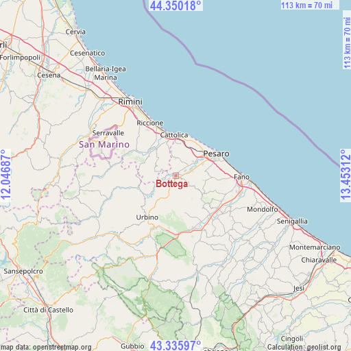
Bottega GPS coordinates[2]
43° 50' 42.828" North, 12° 44' 59.964" East
| Map corner | latitude | longitude |
|---|---|---|
| Upper-left | 44.35018°, | 12.04687° |
| Center: | 43.84523°, | 12.74999° |
| Lower-right: | 43.33597°, | 13.45312° |
| Map W x H: | 112.8×112.8 km | = 70.1×70.1mi |
| max Lat: | 47.04031° ⇑56.4% North |
| Bottega: | 43.84523° |
| min Lat: | ⇓43.6% South 35.50142° |
| min Long | Bottega | max Long |
| 6.69888° | 12.74999° | 18.48682° |
| W 65.6%⇐ | ⇒34.4% E |
Elevation
Elevation of Bottega is 59 m = 194 ft, and this is 247.7 m = 813 ft below average elevation for this country.
| Max E: |
2085 m = 6841 ft | 78.1% |
| Avg. | 306.7 m = 1006 ft | |
| Bottega | 59 m = 194 ft | |
Min E: |
-4 m = -13 ft | 21.9% |
See also: Italy elevation on elevation.city.
Geographical zone
Bottega is located in North temperate zone (between Tropic of Cancer and the Arctic Circle). Distance of this Northern Tropic circle is 2269.2 km =1410 mi to South.| Distance of | km | miles | from Bottega |
|---|---|---|---|
| North Pole | 5131.9 | 3188.8 | to North |
| Arctic Circle | 2526 | 1569.6 | to North |
| Tropic Cancer | 2269.2 | 1410 | to South |
| Equator | 4875.1 | 3029.2 | to South |


Nearby cities:
15 places around Bottega: (largest is in red/bold)
• Borgo Massano
6.1 km =3.8 mi,  248°
248°
• Borgo Santa Maria
5.4 km =3.4 mi,  50°
50°
• Cappone
1.7 km =1.1 mi,  195°
195°
• Colbordolo
3.6 km =2.2 mi,  219°
219°
• Gallo
7.2 km =4.5 mi, 204°
• Mondaino
6.7 km =4.2 mi,  282°
282°
• Monteciccardo
4.9 km =3 mi,  118°
118°
• Montegridolfo
5 km =3.1 mi,  286°
286°
• Montelabbate
3 km =1.9 mi,  85°
85°
• Padiglione
2.4 km =1.5 mi, 287°
• Petriano
7.5 km =4.7 mi,  191°
191°
• Rio Salso-Case Bernardi
4.9 km =3 mi,  255°
255°
• Sant'Angelo in Lizzola
4.6 km =2.9 mi, 116°
• Tavullia
5.9 km =3.7 mi,  0°
0°
• Villa Ceccolini
7.2 km =4.5 mi,  72°
72°
Sources, notices
• [Note1] Compared only with cities in Italy existing in our database
• [Src1] Map data: © OpenStreetMap contributors (CC-BY-SA)
• [Src2] Other city data from geonames.org with taken over terms of usage.
• [Src3] Geographical zone / Annual Mean Temperature by Robert A. Rohde @ Wikipedia
