Villapinta geodata
Villapinta (Lombardy) is a populated place; located in Italy in Europe/Rome (GMT+2) time zone. With population of 1,371 people, there are 5437 cities with bigger population in this country. Compared to other cities in Italy, 95.7% of cities are located further ↓South; 71% of cities are located further →East and 56% of cities have lower elevation than Villapinta. Note1
Administrative division(s):
- Level 1: Lombardy
- Level 2: Provincia di Sondrio
- Level 3: Buglio in Monte


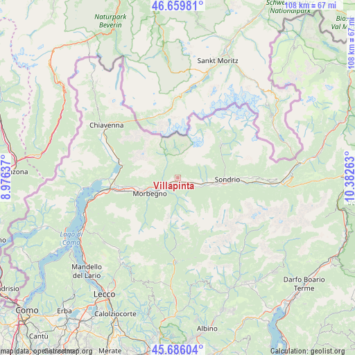
Villapinta GPS coordinates[2]
46° 10' 30.288" North, 9° 40' 46.2" East
| Map corner | latitude | longitude |
|---|---|---|
| Upper-left | 46.65981°, | 8.97637° |
| Center: | 46.17508°, | 9.6795° |
| Lower-right: | 45.68604°, | 10.38263° |
| Map W x H: | 108.3×108.3 km | = 67.3×67.3mi |
| max Lat: | 47.04031° ⇑4.3% North |
| Villapinta: | 46.17508° |
| min Lat: | ⇓95.7% South 35.50142° |
| min Long | Villapinta | max Long |
| 6.69888° | 9.6795° | 18.48682° |
| W 29%⇐ | ⇒71% E |
Elevation
Elevation of Villapinta is 272 m = 892 ft, and this is 34.7 m = 114 ft below average elevation for this country.
| Max E: |
2085 m = 6841 ft | 44% |
| Avg. | 306.7 m = 1006 ft | |
| Villapinta | 272 m = 892 ft | |
Min E: |
-4 m = -13 ft | 56% |
See also: Italy elevation on elevation.city.
Geographical zone
Villapinta is located in North temperate zone (between Tropic of Cancer and the Arctic Circle). Distance of this North polar circle is 2267 km =1408.6 mi to North.| Distance of | km | miles | from Villapinta |
|---|---|---|---|
| North Pole | 4872.9 | 3027.9 | to North |
| Arctic Circle | 2267 | 1408.6 | to North |
| Tropic Cancer | 2528.3 | 1571 | to South |
| Equator | 5134.2 | 3190.2 | to South |


Nearby cities:
15 places around Villapinta: (largest is in red/bold)
• Ardenno
2.6 km =1.6 mi,  250°
250°
• Berbenno di Valtellina
5.3 km =3.3 mi,  100°
100°
• Buglio in Monte
1 km =0.6 mi,  341°
341°
• Campovico
7.6 km =4.7 mi,  244°
244°
• Cataeggio
5.4 km =3.4 mi,  323°
323°
• Cedrasco
7.4 km =4.6 mi,  112°
112°
• Colorina
4.5 km =2.8 mi,  121°
121°
• Dazio
6.3 km =3.9 mi,  255°
255°
• Forcola
2.4 km =1.5 mi,  218°
218°
• Fusine
6.1 km =3.8 mi, 117°
• Postalesio
7.5 km =4.7 mi,  91°
91°
• Sirta
2.3 km =1.4 mi, 217°
• Talamona
6.5 km =4 mi,  231°
231°
• Tartano
7.7 km =4.8 mi,  180°
180°
• Val Masino
5.5 km =3.4 mi, 324°
Sources, notices
• [Note1] Compared only with cities in Italy existing in our database
• [Src1] Map data: © OpenStreetMap contributors (CC-BY-SA)
• [Src2] Other city data from geonames.org with taken over terms of usage.
• [Src3] Geographical zone / Annual Mean Temperature by Robert A. Rohde @ Wikipedia
