Prato geodata
Prato (Emilia-Romagna) is a populated place; located in Italy in Europe/Rome (GMT+2) time zone. With population of 1,218 people, there are 5899 cities with bigger population in this country. Compared to other cities in Italy, 54.5% of cities are located further ↓South; 60.4% of cities are located further →East and 83.4% of cities have higher elevation than Prato. Note1
Administrative division(s):
- Level 1: Emilia-Romagna
- Level 2: Provincia di Reggio Emilia
- Level 3: Correggio


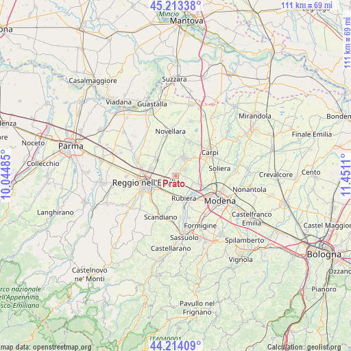
Prato GPS coordinates[2]
44° 42' 57.204" North, 10° 44' 52.692" East
| Map corner | latitude | longitude |
|---|---|---|
| Upper-left | 45.21338°, | 10.04485° |
| Center: | 44.71589°, | 10.74797° |
| Lower-right: | 44.21409°, | 11.4511° |
| Map W x H: | 111.1×111.1 km | = 69×69mi |
| max Lat: | 47.04031° ⇑45.5% North |
| Prato: | 44.71589° |
| min Lat: | ⇓54.5% South 35.50142° |
| min Long | Prato | max Long |
| 6.69888° | 10.74797° | 18.48682° |
| W 39.6%⇐ | ⇒60.4% E |
Elevation
Elevation of Prato is 36 m = 118 ft, and this is 270.7 m = 888 ft below average elevation for this country.
| Max E: |
2085 m = 6841 ft | 83.4% |
| Avg. | 306.7 m = 1006 ft | |
| Prato | 36 m = 118 ft | |
Min E: |
-4 m = -13 ft | 16.6% |
See also: Italy elevation on elevation.city.
Geographical zone
Prato is located in North temperate zone (between Tropic of Cancer and the Arctic Circle). Distance of this Northern Tropic circle is 2366 km =1470.2 mi to South.| Distance of | km | miles | from Prato |
|---|---|---|---|
| North Pole | 5035.1 | 3128.7 | to North |
| Arctic Circle | 2429.2 | 1509.4 | to North |
| Tropic Cancer | 2366 | 1470.2 | to South |
| Equator | 4971.9 | 3089.4 | to South |


Nearby cities:
15 places around Prato: (largest is in red/bold)
• Bagno
6.8 km =4.2 mi,  172°
172°
• Bagnolo in Piano
8 km =5 mi,  312°
312°
• Budrio
3.9 km =2.4 mi,  351°
351°
• Campogalliano
8.4 km =5.2 mi,  111°
111°
• Canolo
8.9 km =5.5 mi,  0°
0°
• Castello di Pratofontana
6.7 km =4.2 mi,  293°
293°
• Correggio
6.4 km =4 mi,  26°
26°
• Fontana
6 km =3.7 mi,  134°
134°
• Fosdondo
6.6 km =4.1 mi, 350°
• Gavasseto
8.9 km =5.5 mi,  219°
219°
• Lemizzone
1.9 km =1.2 mi,  13°
13°
• Massenzatico
4.5 km =2.8 mi,  297°
297°
• Rubiera
7.6 km =4.7 mi,  160°
160°
• San Faustino
4.7 km =2.9 mi,  146°
146°
• San Martino in Rio
3.5 km =2.2 mi,  55°
55°
Sources, notices
• [Note1] Compared only with cities in Italy existing in our database
• [Src1] Map data: © OpenStreetMap contributors (CC-BY-SA)
• [Src2] Other city data from geonames.org with taken over terms of usage.
• [Src3] Geographical zone / Annual Mean Temperature by Robert A. Rohde @ Wikipedia
