Santa Croce Scuole geodata
Santa Croce Scuole (Emilia-Romagna) is a populated place; located in Italy in Europe/Rome (GMT+2) time zone. With population of 1,066 people, there are 6417 cities with bigger population in this country. Compared to other cities in Italy, 55.5% of cities are located further ↓South; 59.2% of cities are located further →East and 84.6% of cities have higher elevation than Santa Croce Scuole. Note1


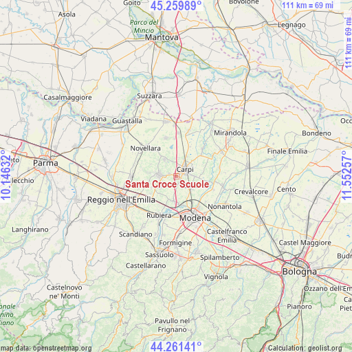
Santa Croce Scuole GPS coordinates[2]
44° 45' 46.116" North, 10° 50' 57.984" East
| Map corner | latitude | longitude |
|---|---|---|
| Upper-left | 45.25989°, | 10.14632° |
| Center: | 44.76281°, | 10.84944° |
| Lower-right: | 44.26141°, | 11.55257° |
| Map W x H: | 111×111 km | = 69×69mi |
| max Lat: | 47.04031° ⇑44.5% North |
| Santa Croce Scuole: | 44.76281° |
| min Lat: | ⇓55.5% South 35.50142° |
| min Long | Santa Croce Scu | max Long |
| 6.69888° | 10.84944° | 18.48682° |
| W 40.8%⇐ | ⇒59.2% E |
Elevation
Elevation of Santa Croce Scuole is 32 m = 105 ft, and this is 274.7 m = 901 ft below average elevation for this country.
| Max E: |
2085 m = 6841 ft | 84.6% |
| Avg. | 306.7 m = 1006 ft | |
| Santa Croce Scuole | 32 m = 105 ft | |
Min E: |
-4 m = -13 ft | 15.4% |
See also: Italy elevation on elevation.city.
Geographical zone
Santa Croce Scuole is located in North temperate zone (between Tropic of Cancer and the Arctic Circle). Distance of this Northern Tropic circle is 2371.2 km =1473.4 mi to South.| Distance of | km | miles | from Santa Croce Scuole |
|---|---|---|---|
| North Pole | 5029.9 | 3125.4 | to North |
| Arctic Circle | 2424 | 1506.2 | to North |
| Tropic Cancer | 2371.2 | 1473.4 | to South |
| Equator | 4977.2 | 3092.7 | to South |


Nearby cities:
15 places around Santa Croce Scuole: (largest is in red/bold)
• Budrio
8.7 km =5.4 mi,  260°
260°
• Budrione
6 km =3.7 mi,  6°
6°
• Campogalliano
8.2 km =5.1 mi,  181°
181°
• Carpi Centro
3.1 km =1.9 mi,  45°
45°
• Correggio
5.2 km =3.2 mi,  275°
275°
• Fossoli
7.3 km =4.5 mi,  25°
25°
• Gargallo
2.4 km =1.5 mi,  157°
157°
• Lemizzone
8.3 km =5.2 mi,  246°
246°
• Limidi
5.6 km =3.5 mi,  88°
88°
• Mandrio
4.7 km =2.9 mi,  314°
314°
• Migliarina
5.4 km =3.4 mi,  348°
348°
• Rio Saliceto
6.5 km =4 mi,  326°
326°
• Sam Marino
7.1 km =4.4 mi, 45°
• San Martino in Rio
6 km =3.7 mi,  237°
237°
• Soliera
6.6 km =4.1 mi,  119°
119°
Sources, notices
• [Note1] Compared only with cities in Italy existing in our database
• [Src1] Map data: © OpenStreetMap contributors (CC-BY-SA)
• [Src2] Other city data from geonames.org with taken over terms of usage.
• [Src3] Geographical zone / Annual Mean Temperature by Robert A. Rohde @ Wikipedia
