Mandrio geodata
Mandrio (Emilia-Romagna) is a populated place; located in Italy in Europe/Rome (GMT+2) time zone. With population of 584 people, there are 9143 cities with bigger population in this country. Compared to other cities in Italy, 56% of cities are located further ↓South; 59.6% of cities are located further →East and 85.6% of cities have higher elevation than Mandrio. Note1
Administrative division(s):
- Level 1: Emilia-Romagna
- Level 2: Provincia di Reggio Emilia
- Level 3: Correggio


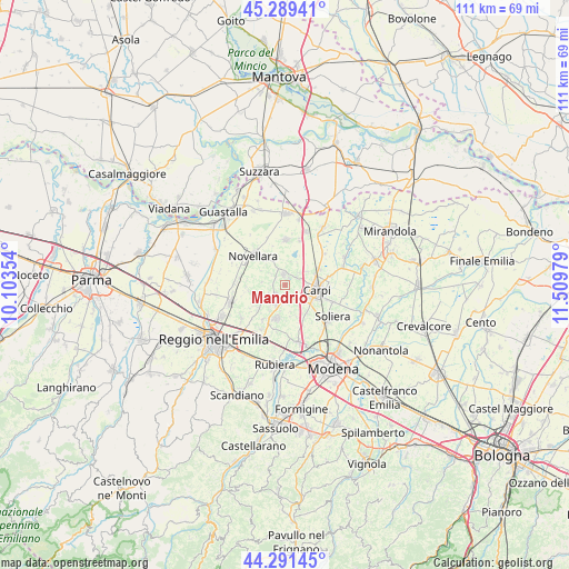
Mandrio GPS coordinates[2]
44° 47' 33.324" North, 10° 48' 23.976" East
| Map corner | latitude | longitude |
|---|---|---|
| Upper-left | 45.28941°, | 10.10354° |
| Center: | 44.79259°, | 10.80666° |
| Lower-right: | 44.29145°, | 11.50979° |
| Map W x H: | 111×111 km | = 69×69mi |
| max Lat: | 47.04031° ⇑44% North |
| Mandrio: | 44.79259° |
| min Lat: | ⇓56% South 35.50142° |
| min Long | Mandrio | max Long |
| 6.69888° | 10.80666° | 18.48682° |
| W 40.4%⇐ | ⇒59.6% E |
Elevation
Elevation of Mandrio is 29 m = 95 ft, and this is 277.7 m = 911 ft below average elevation for this country.
| Max E: |
2085 m = 6841 ft | 85.6% |
| Avg. | 306.7 m = 1006 ft | |
| Mandrio | 29 m = 95 ft | |
Min E: |
-4 m = -13 ft | 14.4% |
See also: Italy elevation on elevation.city.
Geographical zone
Mandrio is located in North temperate zone (between Tropic of Cancer and the Arctic Circle). Distance of this Northern Tropic circle is 2374.6 km =1475.5 mi to South.| Distance of | km | miles | from Mandrio |
|---|---|---|---|
| North Pole | 5026.6 | 3123.4 | to North |
| Arctic Circle | 2420.7 | 1504.2 | to North |
| Tropic Cancer | 2374.6 | 1475.5 | to South |
| Equator | 4980.5 | 3094.7 | to South |


Nearby cities:
15 places around Mandrio: (largest is in red/bold)
• Budrio
7 km =4.3 mi,  228°
228°
• Budrione
4.9 km =3 mi,  57°
57°
• Campagnola Emilia
6.1 km =3.8 mi,  327°
327°
• Canolo
4.5 km =2.8 mi,  274°
274°
• Carpi Centro
5.7 km =3.5 mi,  101°
101°
• Correggio
3.3 km =2.1 mi,  213°
213°
• Fosdondo
6 km =3.7 mi,  250°
250°
• Fossoli
7.3 km =4.5 mi, 63°
• Gargallo
7 km =4.3 mi,  142°
142°
• Lemizzone
7.9 km =4.9 mi, 212°
• Migliarina
3 km =1.9 mi,  49°
49°
• Novellara
8.5 km =5.3 mi,  312°
312°
• Rio Saliceto
2.1 km =1.3 mi,  354°
354°
• San Martino in Rio
6.8 km =4.2 mi,  194°
194°
• Santa Croce Scuole
4.7 km =2.9 mi,  134°
134°
Sources, notices
• [Note1] Compared only with cities in Italy existing in our database
• [Src1] Map data: © OpenStreetMap contributors (CC-BY-SA)
• [Src2] Other city data from geonames.org with taken over terms of usage.
• [Src3] Geographical zone / Annual Mean Temperature by Robert A. Rohde @ Wikipedia
