Beregazzo geodata
Beregazzo (Lombardy) is a populated place; located in Italy in Europe/Rome (GMT+2) time zone. With population of 1,005 people, there are 6642 cities with bigger population in this country. Compared to other cities in Italy, 84.5% of cities are located further ↓South; 81.8% of cities are located further →East and 71.2% of cities have lower elevation than Beregazzo. Note1
Administrative division(s):
- Level 1: Lombardy
- Level 2: Provincia di Como
- Level 3: Beregazzo con Figliaro


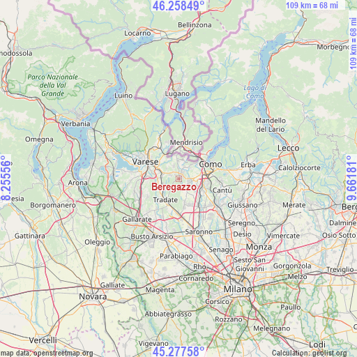
Beregazzo GPS coordinates[2]
45° 46' 12.684" North, 8° 57' 31.284" East
| Map corner | latitude | longitude |
|---|---|---|
| Upper-left | 46.25849°, | 8.25556° |
| Center: | 45.77019°, | 8.95869° |
| Lower-right: | 45.27758°, | 9.66181° |
| Map W x H: | 109.1×109.1 km | = 67.8×67.8mi |
| max Lat: | 47.04031° ⇑15.5% North |
| Beregazzo: | 45.77019° |
| min Lat: | ⇓84.5% South 35.50142° |
| min Long | Beregazzo | max Long |
| 6.69888° | 8.95869° | 18.48682° |
| W 18.2%⇐ | ⇒81.8% E |
Elevation
Elevation of Beregazzo is 406 m = 1332 ft, and this is 99.3 m = 326 ft above average elevation for this country.
| Max E: |
2085 m = 6841 ft | 28.8% |
| Beregazzo | 406 m 1332 ft | |
| Avg. | 306.7 m = 1006 ft | |
Min E: |
-4 m = -13 ft | 71.2% |
See also: Italy elevation on elevation.city.
Geographical zone
Beregazzo is located in North temperate zone (between Tropic of Cancer and the Arctic Circle). Distance of this North polar circle is 2312 km =1436.6 mi to North.| Distance of | km | miles | from Beregazzo |
|---|---|---|---|
| North Pole | 4917.9 | 3055.8 | to North |
| Arctic Circle | 2312 | 1436.6 | to North |
| Tropic Cancer | 2483.2 | 1543 | to South |
| Equator | 5089.2 | 3162.3 | to South |


Nearby cities:
15 places around Beregazzo: (largest is in red/bold)
• Albiolo
4.2 km =2.6 mi,  339°
339°
• Appiano Gentile
4.3 km =2.7 mi,  156°
156°
• Beregazzo con Figliaro
1.6 km =1 mi,  315°
315°
• Binago
3.1 km =1.9 mi,  295°
295°
• Bulgarograsso
4.5 km =2.8 mi,  124°
124°
• Camnago-Boscone
4.2 km =2.6 mi,  22°
22°
• Castelnuovo Bozzente
1.3 km =0.8 mi,  242°
242°
• Faloppio
4.4 km =2.7 mi,  5°
5°
• Figliaro
1.5 km =0.9 mi,  314°
314°
• Gaggino
4.2 km =2.6 mi, 5°
• Gironico al Piano
4.9 km =3 mi,  44°
44°
• Lurate Caccivio
3.1 km =1.9 mi,  96°
96°
• Olgiate Comasco
1.7 km =1.1 mi, 24°
• Oltrona di San Mamette
2.1 km =1.3 mi,  138°
138°
• Solbiate
2.9 km =1.8 mi, 317°
Sources, notices
• [Note1] Compared only with cities in Italy existing in our database
• [Src1] Map data: © OpenStreetMap contributors (CC-BY-SA)
• [Src2] Other city data from geonames.org with taken over terms of usage.
• [Src3] Geographical zone / Annual Mean Temperature by Robert A. Rohde @ Wikipedia
