Pallone geodata
Pallone (Latium) is a populated place; located in Italy in Europe/Rome (GMT+2) time zone. With population of 995 people, there are 6689 cities with bigger population in this country. Compared to other cities in Italy, 66.6% of cities are located further ↑North; 58.3% of cities are located further ←West and 70% of cities have lower elevation than Pallone. Note1


Pallone GPS coordinates[2]
42° 26' 43.62" North, 12° 10' 27.192" East
| Map corner | latitude | longitude |
|---|---|---|
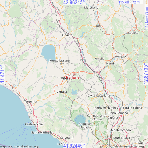
| Upper-left | 42.96215°, | 11.4711° |
| Center: | 42.44545°, | 12.17422° |
| Lower-right: | 41.92445°, | 12.87735° |
| Map W x H: | 115.4×115.4 km | = 71.7×71.7mi |
| max Lat: | 47.04031° ⇑66.6% North |
| Pallone: | 42.44545° |
| min Lat: | ⇓33.4% South 35.50142° |
| min Long | Pallone | max Long |
| 6.69888° | 12.17422° | 18.48682° |
| W 58.3%⇐ | ⇒41.7% E |
Elevation
Elevation of Pallone is 394 m = 1293 ft, and this is 87.3 m = 286 ft above average elevation for this country.
| Max E: |
2085 m = 6841 ft | 30% |
| Pallone | 394 m 1293 ft | |
| Avg. | 306.7 m = 1006 ft | |
Min E: |
-4 m = -13 ft | 70% |
See also: Italy elevation on elevation.city.
Geographical zone
Pallone is located in North temperate zone (between Tropic of Cancer and the Arctic Circle). Distance of this Northern Tropic circle is 2113.6 km =1313.3 mi to South.| Distance of | km | miles | from Pallone |
|---|---|---|---|
| North Pole | 5287.6 | 3285.6 | to North |
| Arctic Circle | 2681.7 | 1666.3 | to North |
| Tropic Cancer | 2113.6 | 1313.3 | to South |
| Equator | 4719.5 | 2932.6 | to South |


Nearby cities:
15 places around Pallone: (largest is in red/bold)
• Attigliano
12.5 km =7.8 mi,  51°
51°
• Bassano in Teverina
11.1 km =6.9 mi,  79°
79°
• Bomarzo
7.5 km =4.7 mi,  56°
56°
• Canepina
8.4 km =5.2 mi,  145°
145°
• Celleno
13.4 km =8.3 mi,  342°
342°
• Grotte Santo Stefano
7.9 km =4.9 mi,  358°
358°
• Paparano
1.6 km =1 mi,  310°
310°
• San Martino al Cimino
9.3 km =5.8 mi,  205°
205°
• Sipicciano
11.8 km =7.3 mi,  21°
21°
• Soriano nel Cimino
5.8 km =3.6 mi,  121°
121°
• Vallerano
9.9 km =6.2 mi,  133°
133°
• Vignanello
11.3 km =7 mi, 130°
• Viterbo
6.3 km =3.9 mi,  242°
242°
• Vitorchiano
2.3 km =1.4 mi,  354°
354°
• Zepponami
13.3 km =8.3 mi, 311°
Sources, notices
• [Note1] Compared only with cities in Italy existing in our database
• [Src1] Map data: © OpenStreetMap contributors (CC-BY-SA)
• [Src2] Other city data from geonames.org with taken over terms of usage.
• [Src3] Geographical zone / Annual Mean Temperature by Robert A. Rohde @ Wikipedia
