Boglietto geodata
Boglietto (Piedmont) is a populated place; located in Italy in Europe/Rome (GMT+2) time zone. With population of 924 people, there are 7009 cities with bigger population in this country. Compared to other cities in Italy, 55.4% of cities are located further ↓South; 91.1% of cities are located further →East and 53.6% of cities have higher elevation than Boglietto. Note1
Administrative division(s):
- Level 1: Piedmont
- Level 2: Provincia di Asti
- Level 3: Costigliole d'Asti


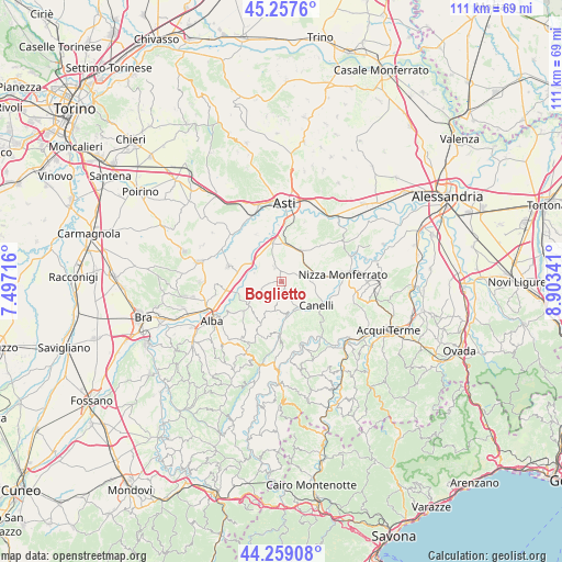
Boglietto GPS coordinates[2]
44° 45' 37.8" North, 8° 12' 1.044" East
| Map corner | latitude | longitude |
|---|---|---|
| Upper-left | 45.2576°, | 7.49716° |
| Center: | 44.7605°, | 8.20029° |
| Lower-right: | 44.25908°, | 8.90341° |
| Map W x H: | 111×111 km | = 69×69mi |
| max Lat: | 47.04031° ⇑44.6% North |
| Boglietto: | 44.7605° |
| min Lat: | ⇓55.4% South 35.50142° |
| min Long | Boglietto | max Long |
| 6.69888° | 8.20029° | 18.48682° |
| W 8.9%⇐ | ⇒91.1% E |
Elevation
Elevation of Boglietto is 213 m = 699 ft, and this is 93.7 m = 307 ft below average elevation for this country.
| Max E: |
2085 m = 6841 ft | 53.6% |
| Avg. | 306.7 m = 1006 ft | |
| Boglietto | 213 m = 699 ft | |
Min E: |
-4 m = -13 ft | 46.4% |
See also: Italy elevation on elevation.city.
Geographical zone
Boglietto is located in North temperate zone (between Tropic of Cancer and the Arctic Circle). Distance of this Northern Tropic circle is 2371 km =1473.3 mi to South.| Distance of | km | miles | from Boglietto |
|---|---|---|---|
| North Pole | 5030.2 | 3125.6 | to North |
| Arctic Circle | 2424.3 | 1506.4 | to North |
| Tropic Cancer | 2371 | 1473.3 | to South |
| Equator | 4976.9 | 3092.5 | to South |


Nearby cities:
15 places around Boglietto: (largest is in red/bold)
• Agliano
5.3 km =3.3 mi,  49°
49°
• Agliano Terme
5.2 km =3.2 mi, 50°
• Bricco di Neive
7.5 km =4.7 mi,  223°
223°
• Calosso
3.1 km =1.9 mi,  137°
137°
• Camo
7.3 km =4.5 mi,  183°
183°
• Castagnole delle Lanze
4.2 km =2.6 mi,  253°
253°
• Castelnuovo Calcea
7.2 km =4.5 mi,  66°
66°
• Castiglione Tinella
4 km =2.5 mi,  191°
191°
• Coazzolo
5.6 km =3.5 mi,  230°
230°
• Costigliole d'Asti
3 km =1.9 mi,  334°
334°
• Moasca
6.2 km =3.9 mi,  86°
86°
• Montegrosso
7.3 km =4.5 mi,  23°
23°
• Motta
7 km =4.3 mi,  323°
323°
• San Marzano Oliveto
7.5 km =4.7 mi,  95°
95°
• Santo Stefano Belbo
6.1 km =3.8 mi,  155°
155°
Sources, notices
• [Note1] Compared only with cities in Italy existing in our database
• [Src1] Map data: © OpenStreetMap contributors (CC-BY-SA)
• [Src2] Other city data from geonames.org with taken over terms of usage.
• [Src3] Geographical zone / Annual Mean Temperature by Robert A. Rohde @ Wikipedia
