Castagnole delle Lanze geodata
Castagnole delle Lanze (Piedmont) is a seat of a third-order administrative division; located in Italy in Europe/Rome (GMT+2) time zone. With population of 2,410 people, there are 3628 cities with bigger population in this country. Compared to other cities in Italy, 55.2% of cities are located further ↓South; 91.6% of cities are located further →East and 55.1% of cities have higher elevation than Castagnole delle Lanze. Note1
Administrative division(s):
- Level 1: Piedmont
- Level 2: Provincia di Asti
- Level 3: Castagnole delle Lanze
Current local time in Castagnole delle Lanze:
09:55 PM, WednesdayDifference from your time zone: hours


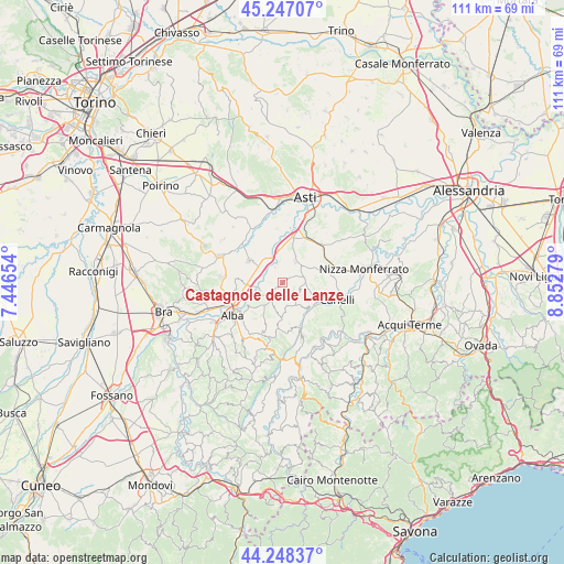
Castagnole delle Lanze GPS coordinates[2]
44° 44' 59.568" North, 8° 8' 58.776" East
| Map corner | latitude | longitude |
|---|---|---|
| Upper-left | 45.24707°, | 7.44654° |
| Center: | 44.74988°, | 8.14966° |
| Lower-right: | 44.24837°, | 8.85279° |
| Map W x H: | 111×111 km | = 69×69mi |
| max Lat: | 47.04031° ⇑44.8% North |
| Castagnole delle Lanze: | 44.74988° |
| min Lat: | ⇓55.2% South 35.50142° |
| min Long | Castagnole dell | max Long |
| 6.69888° | 8.14966° | 18.48682° |
| W 8.4%⇐ | ⇒91.6% E |
Elevation
Elevation of Castagnole delle Lanze is 202 m = 663 ft, and this is 104.7 m = 344 ft below average elevation for this country.
| Max E: |
2085 m = 6841 ft | 55.1% |
| Avg. | 306.7 m = 1006 ft | |
| Castagnole delle Lanze | 202 m = 663 ft | |
Min E: |
-4 m = -13 ft | 44.9% |
See also: Italy elevation on elevation.city.
Geographical zone
Castagnole delle Lanze is located in North temperate zone (between Tropic of Cancer and the Arctic Circle). Distance of this Northern Tropic circle is 2369.8 km =1472.5 mi to South.| Distance of | km | miles | from Castagnole delle Lanze |
|---|---|---|---|
| North Pole | 5031.3 | 3126.3 | to North |
| Arctic Circle | 2425.5 | 1507.1 | to North |
| Tropic Cancer | 2369.8 | 1472.5 | to South |
| Equator | 4975.7 | 3091.8 | to South |


Nearby cities:
15 places around Castagnole delle Lanze: (largest is in red/bold)
• Baraccone
6.9 km =4.3 mi,  266°
266°
• Barbaresco
6.1 km =3.8 mi,  241°
241°
• Boglietto
4.2 km =2.6 mi,  73°
73°
• Bricco di Neive
4.4 km =2.7 mi,  196°
196°
• Calosso
6.2 km =3.9 mi,  100°
100°
• Canove
5.5 km =3.4 mi,  303°
303°
• Castiglione Tinella
4.2 km =2.6 mi,  130°
130°
• Coazzolo
2.4 km =1.5 mi,  188°
188°
• Costigliole d'Asti
4.8 km =3 mi,  34°
34°
• Magliano Alfieri
6.6 km =4.1 mi,  288°
288°
• Mango
6.9 km =4.3 mi,  180°
180°
• Motta
6.8 km =4.2 mi,  358°
358°
• Neive-Borgonovo
3.8 km =2.4 mi,  221°
221°
• Neviglie
6.9 km =4.3 mi, 201°
• Sant'Antonio
6.4 km =4 mi,  279°
279°
Sources, notices
• [Note1] Compared only with cities in Italy existing in our database
• [Src1] Map data: © OpenStreetMap contributors (CC-BY-SA)
• [Src2] Other city data from geonames.org with taken over terms of usage.
• [Src3] Geographical zone / Annual Mean Temperature by Robert A. Rohde @ Wikipedia
