Campagna geodata
Campagna (Friuli Venezia Giulia) is a populated place; located in Italy in Europe/Rome (GMT+2) time zone. With population of 917 people, there are 7046 cities with bigger population in this country. Compared to other cities in Italy, 94.9% of cities are located further ↓South; 65.5% of cities are located further ←West and 51.1% of cities have lower elevation than Campagna. Note1
Administrative division(s):
- Level 1: Friuli Venezia Giulia
- Level 2: Provincia di Pordenone
- Level 3: Maniago


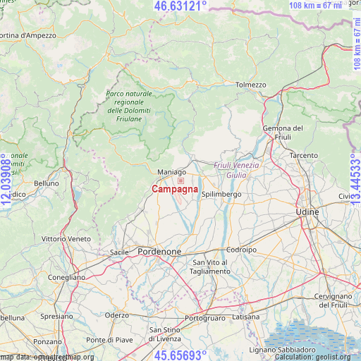
Campagna GPS coordinates[2]
46° 8' 46.428" North, 12° 44' 31.92" East
| Map corner | latitude | longitude |
|---|---|---|
| Upper-left | 46.63121°, | 12.03908° |
| Center: | 46.14623°, | 12.7422° |
| Lower-right: | 45.65693°, | 13.44533° |
| Map W x H: | 108.3×108.3 km | = 67.3×67.3mi |
| max Lat: | 47.04031° ⇑5.1% North |
| Campagna: | 46.14623° |
| min Lat: | ⇓94.9% South 35.50142° |
| min Long | Campagna | max Long |
| 6.69888° | 12.7422° | 18.48682° |
| W 65.5%⇐ | ⇒34.5% E |
Elevation
Elevation of Campagna is 241 m = 791 ft, and this is 65.7 m = 216 ft below average elevation for this country.
| Max E: |
2085 m = 6841 ft | 48.9% |
| Avg. | 306.7 m = 1006 ft | |
| Campagna | 241 m = 791 ft | |
Min E: |
-4 m = -13 ft | 51.1% |
See also: Italy elevation on elevation.city.
Geographical zone
Campagna is located in North temperate zone (between Tropic of Cancer and the Arctic Circle). Distance of this North polar circle is 2270.2 km =1410.6 mi to North.| Distance of | km | miles | from Campagna |
|---|---|---|---|
| North Pole | 4876.1 | 3029.9 | to North |
| Arctic Circle | 2270.2 | 1410.6 | to North |
| Tropic Cancer | 2525.1 | 1569 | to South |
| Equator | 5131 | 3188.3 | to South |


Nearby cities:
15 places around Campagna: (largest is in red/bold)
• Arba
3.7 km =2.3 mi,  90°
90°
• Cavasso Nuovo
5.8 km =3.6 mi,  23°
23°
• Fanna
4.3 km =2.7 mi,  9°
9°
• Frisanco
7.5 km =4.7 mi,  350°
350°
• Giais
10.7 km =6.6 mi,  252°
252°
• Maniago
3.6 km =2.2 mi,  308°
308°
• Meduno
8.8 km =5.5 mi,  29°
29°
• Montereale Valcellina
7.3 km =4.5 mi,  274°
274°
• San Foca
10.4 km =6.5 mi,  200°
200°
• San Leonardo
7.1 km =4.4 mi,  220°
220°
• San Martino Di Campagna
10.7 km =6.6 mi, 220°
• Sequals
7.1 km =4.4 mi,  73°
73°
• Travesio
11.2 km =7 mi,  59°
59°
• Vajont
3.5 km =2.2 mi, 268°
• Vivaro
8.3 km =5.2 mi,  159°
159°
Sources, notices
• [Note1] Compared only with cities in Italy existing in our database
• [Src1] Map data: © OpenStreetMap contributors (CC-BY-SA)
• [Src2] Other city data from geonames.org with taken over terms of usage.
• [Src3] Geographical zone / Annual Mean Temperature by Robert A. Rohde @ Wikipedia
