Madrigale geodata
Madrigale (Tuscany) is a populated place; located in Italy in Europe/Rome (GMT+2) time zone. With population of 660 people, there are 8557 cities with bigger population in this country. Compared to other cities in Italy, 59.2% of cities are located further ↑North; 50.1% of cities are located further ←West and 63.3% of cities have higher elevation than Madrigale. Note1
Administrative division(s):
- Level 1: Tuscany
- Level 2: Province of Arezzo
- Level 3: Terranuova Bracciolini


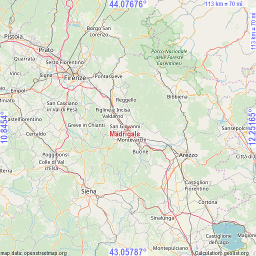
Madrigale GPS coordinates[2]
43° 34' 10.092" North, 11° 32' 54.672" East
| Map corner | latitude | longitude |
|---|---|---|
| Upper-left | 44.07676°, | 10.8454° |
| Center: | 43.56947°, | 11.54852° |
| Lower-right: | 43.05787°, | 12.25165° |
| Map W x H: | 113.3×113.3 km | = 70.4×70.4mi |
| max Lat: | 47.04031° ⇑59.2% North |
| Madrigale: | 43.56947° |
| min Lat: | ⇓40.8% South 35.50142° |
| min Long | Madrigale | max Long |
| 6.69888° | 11.54852° | 18.48682° |
| W 50.1%⇐ | ⇒49.9% E |
Elevation
Elevation of Madrigale is 139 m = 456 ft, and this is 167.7 m = 550 ft below average elevation for this country.
| Max E: |
2085 m = 6841 ft | 63.3% |
| Avg. | 306.7 m = 1006 ft | |
| Madrigale | 139 m = 456 ft | |
Min E: |
-4 m = -13 ft | 36.7% |
See also: Italy elevation on elevation.city.
Geographical zone
Madrigale is located in North temperate zone (between Tropic of Cancer and the Arctic Circle). Distance of this Northern Tropic circle is 2238.6 km =1391 mi to South.| Distance of | km | miles | from Madrigale |
|---|---|---|---|
| North Pole | 5162.6 | 3207.9 | to North |
| Arctic Circle | 2556.7 | 1588.7 | to North |
| Tropic Cancer | 2238.6 | 1391 | to South |
| Equator | 4844.5 | 3010.2 | to South |


Nearby cities:
15 places around Madrigale: (largest is in red/bold)
• Castelfranco di Sopra
5.9 km =3.7 mi,  8°
8°
• Cavriglia-Monastero
7.4 km =4.6 mi,  222°
222°
• Faella
6.8 km =4.2 mi,  339°
339°
• Figline Valdarno
8.3 km =5.2 mi,  312°
312°
• Loro Ciuffenna
6.8 km =4.2 mi,  72°
72°
• Meleto
6.7 km =4.2 mi,  269°
269°
• Montevarchi
5.3 km =3.3 mi,  158°
158°
• Neri
8.1 km =5 mi,  240°
240°
• Penna
5 km =3.1 mi,  93°
93°
• Pian di Scò
8.1 km =5 mi,  358°
358°
• San Cipriano-S.Barbara-Centinale
5.1 km =3.2 mi, 268°
• San Giovanni Valdarno
1.5 km =0.9 mi,  261°
261°
• Terranuova Bracciolini
3.3 km =2.1 mi,  128°
128°
• Vacchereccia
3.9 km =2.4 mi, 256°
• Ville
1.9 km =1.2 mi,  100°
100°
Sources, notices
• [Note1] Compared only with cities in Italy existing in our database
• [Src1] Map data: © OpenStreetMap contributors (CC-BY-SA)
• [Src2] Other city data from geonames.org with taken over terms of usage.
• [Src3] Geographical zone / Annual Mean Temperature by Robert A. Rohde @ Wikipedia
