Mussolini geodata
Mussolini (Veneto) is a populated place; located in Italy in Europe/Rome (GMT+2) time zone. With population of 597 people, there are 9041 cities with bigger population in this country. Compared to other cities in Italy, 74% of cities are located further ↓South; 55.5% of cities are located further ←West and 92.6% of cities have higher elevation than Mussolini. Note1
Administrative division(s):
- Level 1: Veneto
- Level 2: Provincia di Padova
- Level 3: Villanova di Camposampiero


Mussolini GPS coordinates[2]
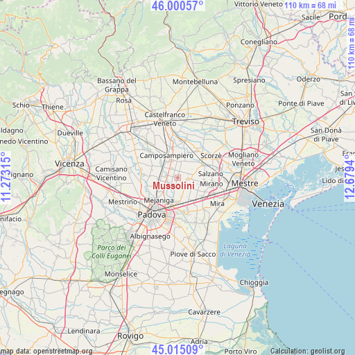
45° 30' 35.964" North, 11° 58' 34.572" East
| Map corner | latitude | longitude |
|---|---|---|
| Upper-left | 46.00057°, | 11.27315° |
| Center: | 45.50999°, | 11.97627° |
| Lower-right: | 45.01509°, | 12.6794° |
| Map W x H: | 109.6×109.6 km | = 68.1×68.1mi |
| max Lat: | 47.04031° ⇑26% North |
| Mussolini: | 45.50999° |
| min Lat: | ⇓74% South 35.50142° |
| min Long | Mussolini | max Long |
| 6.69888° | 11.97627° | 18.48682° |
| W 55.5%⇐ | ⇒44.5% E |
Elevation
Elevation of Mussolini is 13 m = 43 ft, and this is 293.7 m = 964 ft below average elevation for this country.
| Max E: |
2085 m = 6841 ft | 92.6% |
| Avg. | 306.7 m = 1006 ft | |
| Mussolini | 13 m = 43 ft | |
Min E: |
-4 m = -13 ft | 7.4% |
See also: Italy elevation on elevation.city.
Geographical zone
Mussolini is located in North temperate zone (between Tropic of Cancer and the Arctic Circle). Distance of this North polar circle is 2340.9 km =1454.6 mi to North.| Distance of | km | miles | from Mussolini |
|---|---|---|---|
| North Pole | 4946.8 | 3073.8 | to North |
| Arctic Circle | 2340.9 | 1454.6 | to North |
| Tropic Cancer | 2454.3 | 1525 | to South |
| Equator | 5060.2 | 3144.3 | to South |


Nearby cities:
15 places around Mussolini: (largest is in red/bold)
• Borgoricco-San Michele delle Badesse-Sant'Eufemia
3.9 km =2.4 mi,  315°
315°
• Caltana
5.2 km =3.2 mi,  125°
125°
• Campodarsego
4.4 km =2.7 mi,  252°
252°
• Caselle
3.5 km =2.2 mi,  138°
138°
• Codiverno
4.5 km =2.8 mi,  212°
212°
• Massanzago-Ca' Baglioni-San Dono
5.7 km =3.5 mi,  25°
25°
• Pianiga
6.4 km =4 mi,  157°
157°
• Pionca
5 km =3.1 mi,  192°
192°
• Rustega
6.6 km =4.1 mi,  359°
359°
• Sant'Angelo
3.5 km =2.2 mi,  70°
70°
• Santa Maria di Sala
4.6 km =2.9 mi,  94°
94°
• Stigliano
5.5 km =3.4 mi, 73°
• Veternigo
6.4 km =4 mi,  82°
82°
• Villanova
2.3 km =1.4 mi,  182°
182°
• Zeminiana
4.5 km =2.8 mi,  55°
55°
Sources, notices
• [Note1] Compared only with cities in Italy existing in our database
• [Src1] Map data: © OpenStreetMap contributors (CC-BY-SA)
• [Src2] Other city data from geonames.org with taken over terms of usage.
• [Src3] Geographical zone / Annual Mean Temperature by Robert A. Rohde @ Wikipedia
