Sabina geodata
Sabina (Campania) is a populated place; located in Italy in Europe/Rome (GMT+2) time zone. With population of 565 people, there are 9298 cities with bigger population in this country. Compared to other cities in Italy, 79.9% of cities are located further ↑North; 85.6% of cities are located further ←West and 69.4% of cities have lower elevation than Sabina. Note1
Administrative division(s):
- Level 1: Campania
- Level 2: Provincia di Avellino
- Level 3: Aiello del Sabato


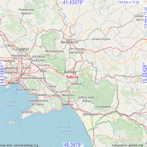
Sabina GPS coordinates[2]
40° 54' 5.328" North, 14° 49' 16.068" East
| Map corner | latitude | longitude |
|---|---|---|
| Upper-left | 41.43079°, | 14.11801° |
| Center: | 40.90148°, | 14.82113° |
| Lower-right: | 40.3679°, | 15.52426° |
| Map W x H: | 118.2×118.2 km | = 73.4×73.4mi |
| max Lat: | 47.04031° ⇑79.9% North |
| Sabina: | 40.90148° |
| min Lat: | ⇓20.1% South 35.50142° |
| min Long | Sabina | max Long |
| 6.69888° | 14.82113° | 18.48682° |
| W 85.6%⇐ | ⇒14.4% E |
Elevation
Elevation of Sabina is 388 m = 1273 ft, and this is 81.3 m = 267 ft above average elevation for this country.
| Max E: |
2085 m = 6841 ft | 30.6% |
| Sabina | 388 m 1273 ft | |
| Avg. | 306.7 m = 1006 ft | |
Min E: |
-4 m = -13 ft | 69.4% |
See also: Italy elevation on elevation.city.
Geographical zone
Sabina is located in North temperate zone (between Tropic of Cancer and the Arctic Circle). Distance of this Northern Tropic circle is 1941.9 km =1206.6 mi to South.| Distance of | km | miles | from Sabina |
|---|---|---|---|
| North Pole | 5459.2 | 3392.2 | to North |
| Arctic Circle | 2853.4 | 1773 | to North |
| Tropic Cancer | 1941.9 | 1206.6 | to South |
| Equator | 4547.8 | 2825.9 | to South |


Nearby cities:
15 places around Sabina: (largest is in red/bold)
• Aiello del Sabato
1.4 km =0.9 mi,  179°
179°
• Alvanite
0.8 km =0.5 mi,  34°
34°
• Atripalda
2 km =1.2 mi,  14°
14°
• Avellino
2.9 km =1.8 mi,  300°
300°
• Bellizzi Irpino
2.3 km =1.4 mi,  236°
236°
• Cesinali
0.7 km =0.4 mi,  131°
131°
• Contrada
5.2 km =3.2 mi,  224°
224°
• Manocalzati
5 km =3.1 mi, 26°
• Molinelle
5 km =3.1 mi,  271°
271°
• San Michele di Serino
4 km =2.5 mi,  135°
135°
• San Potito Ultra
5.1 km =3.2 mi,  55°
55°
• Santa Lucia di Serino
5.8 km =3.6 mi, 126°
• Santo Stefano del Sole
3.9 km =2.4 mi,  102°
102°
• Sorbo Serpico
5.8 km =3.6 mi,  72°
72°
• Torelli-Torrette
5.9 km =3.7 mi,  276°
276°
Sources, notices
• [Note1] Compared only with cities in Italy existing in our database
• [Src1] Map data: © OpenStreetMap contributors (CC-BY-SA)
• [Src2] Other city data from geonames.org with taken over terms of usage.
• [Src3] Geographical zone / Annual Mean Temperature by Robert A. Rohde @ Wikipedia
