Monasterolo geodata
Monasterolo (Lombardy) is a seat of a third-order administrative division; located in Italy in Europe/Rome (GMT+2) time zone. With population of 534 people, there are 9605 cities with bigger population in this country. Compared to other cities in Italy, 84.2% of cities are located further ↓South; 68.5% of cities are located further →East and 65.9% of cities have lower elevation than Monasterolo. Note1
Administrative division(s):
- Level 1: Lombardy
- Level 2: Provincia di Bergamo
- Level 3: Monasterolo del Castello


Monasterolo GPS coordinates[2]
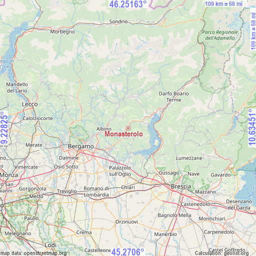
45° 45' 47.772" North, 9° 55' 52.968" East
| Map corner | latitude | longitude |
|---|---|---|
| Upper-left | 46.25163°, | 9.22825° |
| Center: | 45.76327°, | 9.93138° |
| Lower-right: | 45.2706°, | 10.63451° |
| Map W x H: | 109.1×109.1 km | = 67.8×67.8mi |
| max Lat: | 47.04031° ⇑15.8% North |
| Monasterolo: | 45.76327° |
| min Lat: | ⇓84.2% South 35.50142° |
| min Long | Monasterolo | max Long |
| 6.69888° | 9.93138° | 18.48682° |
| W 31.5%⇐ | ⇒68.5% E |
Elevation
Elevation of Monasterolo is 352 m = 1155 ft, and this is 45.3 m = 149 ft above average elevation for this country.
| Max E: |
2085 m = 6841 ft | 34.1% |
| Monasterolo | 352 m 1155 ft | |
| Avg. | 306.7 m = 1006 ft | |
Min E: |
-4 m = -13 ft | 65.9% |
See also: Italy elevation on elevation.city.
Geographical zone
Monasterolo is located in North temperate zone (between Tropic of Cancer and the Arctic Circle). Distance of this North polar circle is 2312.8 km =1437.1 mi to North.| Distance of | km | miles | from Monasterolo |
|---|---|---|---|
| North Pole | 4918.7 | 3056.3 | to North |
| Arctic Circle | 2312.8 | 1437.1 | to North |
| Tropic Cancer | 2482.5 | 1542.6 | to South |
| Equator | 5088.4 | 3161.8 | to South |


Nearby cities:
15 places around Monasterolo: (largest is in red/bold)
• Adrara San Rocco
5.7 km =3.5 mi,  157°
157°
• Berzo San Fermo
5.3 km =3.3 mi,  204°
204°
• Bianzano
1.5 km =0.9 mi,  316°
316°
• Borgo di Terzo
5.7 km =3.5 mi,  213°
213°
• Casazza
2.5 km =1.6 mi,  229°
229°
• Endine
4.5 km =2.8 mi,  49°
49°
• Gaverina Terme
3.6 km =2.2 mi,  256°
256°
• Grone
4.4 km =2.7 mi, 203°
• Leffe
5.3 km =3.3 mi, 316°
• Monasterolo del Castello
0 km =0 mi,  112°
112°
• Peia
4.7 km =2.9 mi,  328°
328°
• Piangaiano
5.7 km =3.5 mi,  59°
59°
• Ranzanico
2.8 km =1.7 mi,  5°
5°
• Spinone al Lago
0.8 km =0.5 mi,  282°
282°
• Vigano San Martino
5 km =3.1 mi, 213°
Sources, notices
• [Note1] Compared only with cities in Italy existing in our database
• [Src1] Map data: © OpenStreetMap contributors (CC-BY-SA)
• [Src2] Other city data from geonames.org with taken over terms of usage.
• [Src3] Geographical zone / Annual Mean Temperature by Robert A. Rohde @ Wikipedia
