Ranzanico geodata
Ranzanico (Lombardy) is a seat of a third-order administrative division; located in Italy in Europe/Rome (GMT+2) time zone. With population of 459 people, there are 10052 cities with bigger population in this country. Compared to other cities in Italy, 85.2% of cities are located further ↓South; 68.4% of cities are located further →East and 78.2% of cities have lower elevation than Ranzanico. Note1


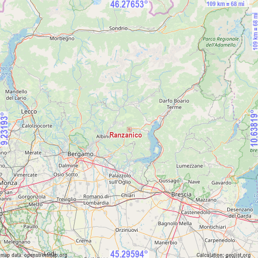
Ranzanico GPS coordinates[2]
45° 47' 18.204" North, 9° 56' 6.216" East
| Map corner | latitude | longitude |
|---|---|---|
| Upper-left | 46.27653°, | 9.23193° |
| Center: | 45.78839°, | 9.93506° |
| Lower-right: | 45.29594°, | 10.63819° |
| Map W x H: | 109×109 km | = 67.7×67.7mi |
| max Lat: | 47.04031° ⇑14.8% North |
| Ranzanico: | 45.78839° |
| min Lat: | ⇓85.2% South 35.50142° |
| min Long | Ranzanico | max Long |
| 6.69888° | 9.93506° | 18.48682° |
| W 31.6%⇐ | ⇒68.4% E |
Elevation
Elevation of Ranzanico is 495 m = 1624 ft, and this is 188.3 m = 618 ft above average elevation for this country.
| Max E: |
2085 m = 6841 ft | 21.8% |
| Ranzanico | 495 m 1624 ft | |
| Avg. | 306.7 m = 1006 ft | |
Min E: |
-4 m = -13 ft | 78.2% |
See also: Italy elevation on elevation.city.
Geographical zone
Ranzanico is located in North temperate zone (between Tropic of Cancer and the Arctic Circle). Distance of this North polar circle is 2310 km =1435.4 mi to North.| Distance of | km | miles | from Ranzanico |
|---|---|---|---|
| North Pole | 4915.9 | 3054.6 | to North |
| Arctic Circle | 2310 | 1435.4 | to North |
| Tropic Cancer | 2485.3 | 1544.3 | to South |
| Equator | 5091.2 | 3163.5 | to South |


Nearby cities:
15 places around Ranzanico: (largest is in red/bold)
• Bianzano
2.1 km =1.3 mi,  217°
217°
• Casazza
5 km =3.1 mi,  206°
206°
• Casnigo
5.8 km =3.6 mi,  298°
298°
• Cazzano Sant'Andrea
4.6 km =2.9 mi, 303°
• Colzate
6.9 km =4.3 mi, 297°
• Endine
3.1 km =1.9 mi,  87°
87°
• Gandino
3.8 km =2.4 mi,  310°
310°
• Gaverina Terme
5.2 km =3.2 mi,  225°
225°
• Leffe
4.1 km =2.5 mi,  285°
285°
• Monasterolo
2.8 km =1.7 mi,  185°
185°
• Monasterolo del Castello
2.8 km =1.7 mi, 185°
• Peia
3 km =1.9 mi, 293°
• Piangaiano
4.6 km =2.9 mi, 89°
• Solto Collina
7.1 km =4.4 mi,  95°
95°
• Spinone al Lago
2.8 km =1.7 mi,  201°
201°
Sources, notices
• [Note1] Compared only with cities in Italy existing in our database
• [Src1] Map data: © OpenStreetMap contributors (CC-BY-SA)
• [Src2] Other city data from geonames.org with taken over terms of usage.
• [Src3] Geographical zone / Annual Mean Temperature by Robert A. Rohde @ Wikipedia
