Villanuova geodata
Villanuova (Lombardy) is a seat of a third-order administrative division; located in Italy in Europe/Rome (GMT+2) time zone. With population of 495 people, there are 9949 cities with bigger population in this country. Compared to other cities in Italy, 71.7% of cities are located further ↓South; 69.2% of cities are located further →East and 70.9% of cities have higher elevation than Villanuova. Note1
Administrative division(s):
- Level 1: Lombardy
- Level 2: Provincia di Bergamo
- Level 3: Torre Pallavicina


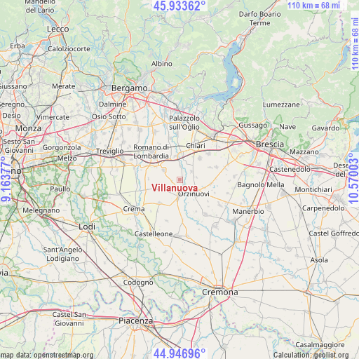
Villanuova GPS coordinates[2]
45° 26' 32.82" North, 9° 52' 0.84" East
| Map corner | latitude | longitude |
|---|---|---|
| Upper-left | 45.93362°, | 9.16377° |
| Center: | 45.44245°, | 9.8669° |
| Lower-right: | 44.94696°, | 10.57003° |
| Map W x H: | 109.7×109.7 km | = 68.2×68.2mi |
| max Lat: | 47.04031° ⇑28.3% North |
| Villanuova: | 45.44245° |
| min Lat: | ⇓71.7% South 35.50142° |
| min Long | Villanuova | max Long |
| 6.69888° | 9.8669° | 18.48682° |
| W 30.8%⇐ | ⇒69.2% E |
Elevation
Elevation of Villanuova is 93 m = 305 ft, and this is 213.7 m = 701 ft below average elevation for this country.
| Max E: |
2085 m = 6841 ft | 70.9% |
| Avg. | 306.7 m = 1006 ft | |
| Villanuova | 93 m = 305 ft | |
Min E: |
-4 m = -13 ft | 29.1% |
See also: Italy elevation on elevation.city.
Geographical zone
Villanuova is located in North temperate zone (between Tropic of Cancer and the Arctic Circle). Distance of this North polar circle is 2348.4 km =1459.2 mi to North.| Distance of | km | miles | from Villanuova |
|---|---|---|---|
| North Pole | 4954.3 | 3078.5 | to North |
| Arctic Circle | 2348.4 | 1459.2 | to North |
| Tropic Cancer | 2446.8 | 1520.4 | to South |
| Equator | 5052.7 | 3139.6 | to South |


Nearby cities:
15 places around Villanuova: (largest is in red/bold)
• Antegnate
7.7 km =4.8 mi,  309°
309°
• Calcio
7.4 km =4.6 mi,  349°
349°
• Casaletto di Sopra
7.1 km =4.4 mi,  248°
248°
• Cizzago
7.2 km =4.5 mi,  63°
63°
• Cizzago-Comezzano
7.7 km =4.8 mi,  67°
67°
• Fontanella
5.8 km =3.6 mi,  300°
300°
• Gallignano
2.3 km =1.4 mi,  256°
256°
• Ludriano
5.2 km =3.2 mi,  82°
82°
• Orzinuovi
6.3 km =3.9 mi,  135°
135°
• Orzivecchi
7.9 km =4.9 mi,  107°
107°
• Pumenengo
4.2 km =2.6 mi,  0°
0°
• Roccafranca
4.3 km =2.7 mi, 56°
• Rudiano
5.4 km =3.4 mi,  15°
15°
• Soncino
4.7 km =2.9 mi,  178°
178°
• Torre Pallavicina
0.9 km =0.6 mi, 61°
Sources, notices
• [Note1] Compared only with cities in Italy existing in our database
• [Src1] Map data: © OpenStreetMap contributors (CC-BY-SA)
• [Src2] Other city data from geonames.org with taken over terms of usage.
• [Src3] Geographical zone / Annual Mean Temperature by Robert A. Rohde @ Wikipedia
