Antegnate geodata
Antegnate (Lombardy) is a seat of a third-order administrative division; located in Italy in Europe/Rome (GMT+2) time zone. With population of 2,915 people, there are 3113 cities with bigger population in this country. Compared to other cities in Italy, 73.1% of cities are located further ↓South; 69.8% of cities are located further →East and 67.8% of cities have higher elevation than Antegnate. Note1


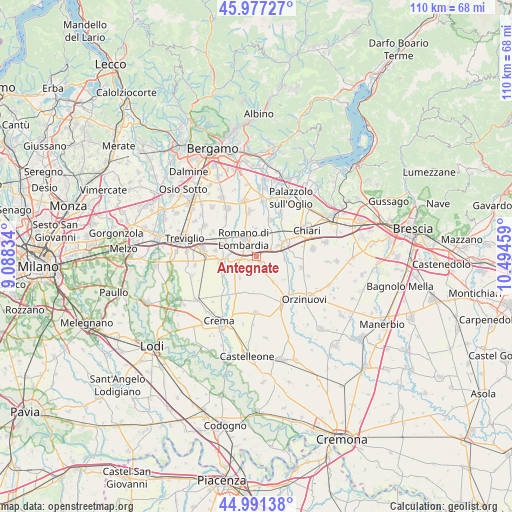
Antegnate GPS coordinates[2]
45° 29' 11.328" North, 9° 47' 29.256" East
| Map corner | latitude | longitude |
|---|---|---|
| Upper-left | 45.97727°, | 9.08834° |
| Center: | 45.48648°, | 9.79146° |
| Lower-right: | 44.99138°, | 10.49459° |
| Map W x H: | 109.6×109.6 km | = 68.1×68.1mi |
| max Lat: | 47.04031° ⇑26.9% North |
| Antegnate: | 45.48648° |
| min Lat: | ⇓73.1% South 35.50142° |
| min Long | Antegnate | max Long |
| 6.69888° | 9.79146° | 18.48682° |
| W 30.2%⇐ | ⇒69.8% E |
Elevation
Elevation of Antegnate is 110 m = 361 ft, and this is 196.7 m = 645 ft below average elevation for this country.
| Max E: |
2085 m = 6841 ft | 67.8% |
| Avg. | 306.7 m = 1006 ft | |
| Antegnate | 110 m = 361 ft | |
Min E: |
-4 m = -13 ft | 32.2% |
See also: Italy elevation on elevation.city.
Geographical zone
Antegnate is located in North temperate zone (between Tropic of Cancer and the Arctic Circle). Distance of this North polar circle is 2343.6 km =1456.2 mi to North.| Distance of | km | miles | from Antegnate |
|---|---|---|---|
| North Pole | 4949.4 | 3075.4 | to North |
| Arctic Circle | 2343.6 | 1456.2 | to North |
| Tropic Cancer | 2451.7 | 1523.4 | to South |
| Equator | 5057.6 | 3142.6 | to South |


Nearby cities:
15 places around Antegnate: (largest is in red/bold)
• Barbata
1.7 km =1.1 mi,  220°
220°
• Calcio
5.1 km =3.2 mi,  61°
61°
• Camisano
5.9 km =3.7 mi, 217°
• Castel Gabbiano
6.1 km =3.8 mi,  250°
250°
• Cortenuova
5.8 km =3.6 mi,  357°
357°
• Cortenuova di Sopra
6.4 km =4 mi,  352°
352°
• Covo
2.1 km =1.3 mi,  310°
310°
• Fara Olivana
3.4 km =2.1 mi,  286°
286°
• Fontanella
2.1 km =1.3 mi,  156°
156°
• Gallignano
6.5 km =4 mi,  146°
146°
• Isso
2.8 km =1.7 mi, 247°
• Pumenengo
6 km =3.7 mi,  96°
96°
• Romano di Lombardia
4.8 km =3 mi,  322°
322°
• Rudiano
7.4 km =4.6 mi,  87°
87°
• Urago d'Oglio
6.9 km =4.3 mi, 61°
Sources, notices
• [Note1] Compared only with cities in Italy existing in our database
• [Src1] Map data: © OpenStreetMap contributors (CC-BY-SA)
• [Src2] Other city data from geonames.org with taken over terms of usage.
• [Src3] Geographical zone / Annual Mean Temperature by Robert A. Rohde @ Wikipedia
