Villa geodata
Villa (Lombardy) is a seat of a third-order administrative division; located in Italy in Europe/Rome (GMT+2) time zone. With population of 772 people, there are 7806 cities with bigger population in this country. Compared to other cities in Italy, 97.2% of cities are located further ↓South; 73.5% of cities are located further →East and 86.7% of cities have lower elevation than Villa. Note1
Administrative division(s):
- Level 1: Lombardy
- Level 2: Provincia di Sondrio
- Level 3: Villa di Chiavenna


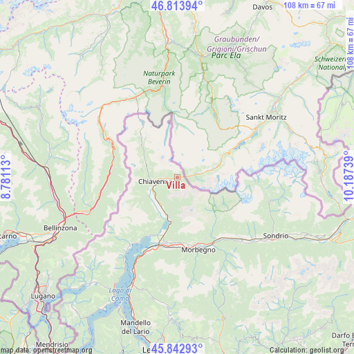
Villa GPS coordinates[2]
46° 19' 50.124" North, 9° 29' 3.336" East
| Map corner | latitude | longitude |
|---|---|---|
| Upper-left | 46.81394°, | 8.78113° |
| Center: | 46.33059°, | 9.48426° |
| Lower-right: | 45.84293°, | 10.18739° |
| Map W x H: | 108×108 km | = 67.1×67.1mi |
| max Lat: | 47.04031° ⇑2.8% North |
| Villa: | 46.33059° |
| min Lat: | ⇓97.2% South 35.50142° |
| min Long | Villa | max Long |
| 6.69888° | 9.48426° | 18.48682° |
| W 26.5%⇐ | ⇒73.5% E |
Elevation
Elevation of Villa is 647 m = 2123 ft, and this is 340.3 m = 1116 ft above average elevation for this country.
| Max E: |
2085 m = 6841 ft | 13.3% |
| Villa | 647 m 2123 ft | |
| Avg. | 306.7 m = 1006 ft | |
Min E: |
-4 m = -13 ft | 86.7% |
See also: Italy elevation on elevation.city.
Geographical zone
Villa is located in North temperate zone (between Tropic of Cancer and the Arctic Circle). Distance of this North polar circle is 2249.7 km =1397.9 mi to North.| Distance of | km | miles | from Villa |
|---|---|---|---|
| North Pole | 4855.6 | 3017.1 | to North |
| Arctic Circle | 2249.7 | 1397.9 | to North |
| Tropic Cancer | 2545.6 | 1581.8 | to South |
| Equator | 5151.5 | 3201 | to South |


Nearby cities:
15 places around Villa: (largest is in red/bold)
• Borgonuovo
3.6 km =2.2 mi,  267°
267°
• Chiavenna
6.7 km =4.2 mi,  260°
260°
• Gordona
10 km =6.2 mi,  244°
244°
• Menarola
10.1 km =6.3 mi,  249°
249°
• Mese
8.7 km =5.4 mi, 249°
• Piuro
4.9 km =3 mi, 268°
• Prata Camportaccio
7.3 km =4.5 mi, 249°
• Prata Centro
7.2 km =4.5 mi, 250°
• Prosto
4.9 km =3 mi, 268°
• San Cassiano
8.9 km =5.5 mi,  228°
228°
• San Giacomo Filippo
8.7 km =5.4 mi,  275°
275°
• San Pietro
11.1 km =6.9 mi,  223°
223°
• San Vittore
8.2 km =5.1 mi, 252°
• Somaggia
9.8 km =6.1 mi,  209°
209°
• Villa di Chiavenna
0.2 km =0.1 mi, 272°
Sources, notices
• [Note1] Compared only with cities in Italy existing in our database
• [Src1] Map data: © OpenStreetMap contributors (CC-BY-SA)
• [Src2] Other city data from geonames.org with taken over terms of usage.
• [Src3] Geographical zone / Annual Mean Temperature by Robert A. Rohde @ Wikipedia
