Yaizu geodata
Yaizu (Shizuoka) is a seat of a second-order administrative division; located in Japan in Asia/Tokyo (GMT+9) time zone. With population of 121,057 people, there are 176 cities with bigger population in this country. Compared to other cities in Japan, 62% of cities are located further ↑North; 55.5% of cities are located further ←West and 79% of cities have higher elevation than Yaizu. Note1


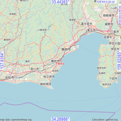
Yaizu GPS coordinates[2]
34° 52' 7.572" North, 138° 19' 10.272" East
| Map corner | latitude | longitude |
|---|---|---|
| Upper-left | 35.44363°, | 137.6164° |
| Center: | 34.86877°, | 138.31952° |
| Lower-right: | 34.28986°, | 139.02265° |
| Map W x H: | 128.3×128.3 km | = 79.7×79.7mi |
| max Lat: | 45.40944° ⇑62% North |
| Yaizu: | 34.86877° |
| min Lat: | ⇓38% South 24.34478° |
| min Long | Yaizu | max Long |
| 123° | 138.31952° | 145.575° |
| W 55.5%⇐ | ⇒44.5% E |
Elevation
Elevation of Yaizu is 8 m = 26 ft, and this is 76.6 m = 251 ft below average elevation for this country.
| Max E: |
1086 m = 3563 ft | 79% |
| Avg. | 84.6 m = 278 ft | |
| Yaizu | 8 m = 26 ft | |
Min E: |
-2 m = -7 ft | 21% |
See also: Yaizu elevation on elevation.city.
Geographical zone
Yaizu is located in North temperate zone (between Tropic of Cancer and the Arctic Circle). Distance of this Northern Tropic circle is 1271.1 km =789.8 mi to South.| Distance of | km | miles | from Yaizu |
|---|---|---|---|
| North Pole | 6130 | 3809 | to North |
| Arctic Circle | 3524.1 | 2189.8 | to North |
| Tropic Cancer | 1271.1 | 789.8 | to South |
| Equator | 3877 | 2409.1 | to South |


Nearby cities:
15 places around Yaizu: (largest is in red/bold)
• Fuji
46.8 km =29.1 mi,  45°
45°
• Fujieda
4.8 km =3 mi,  267°
267°
• Fukuroi
39.1 km =24.3 mi,  250°
250°
• Heda
43.7 km =27.2 mi,  76°
76°
• Iwata
46.8 km =29.1 mi, 246°
• Kakegawa
29.9 km =18.6 mi, 247°
• Kanaya
18.3 km =11.4 mi, 252°
• Kikugawa
25.9 km =16.1 mi,  224°
224°
• Makinohara
18.8 km =11.7 mi,  236°
236°
• Mori
35.5 km =22.1 mi,  263°
263°
• Omaezaki
31.4 km =19.5 mi,  196°
196°
• Sagara
23 km =14.3 mi,  207°
207°
• Shimada
13.7 km =8.5 mi, 245°
• Shizuoka
14 km =8.7 mi,  24°
24°
• Ōyama
30.9 km =19.2 mi, 197°
Sources, notices
• [Note1] Compared only with cities in Japan existing in our database
• [Src1] Map data: © OpenStreetMap contributors (CC-BY-SA)
• [Src2] Other city data from geonames.org with taken over terms of usage.
• [Src3] Geographical zone / Annual Mean Temperature by Robert A. Rohde @ Wikipedia
