Kanaya geodata
Kanaya (Shizuoka) is a populated place; located in Japan in Asia/Tokyo (GMT+9) time zone. With population of 20,286 people, there are 688 cities with bigger population in this country. Compared to other cities in Japan, 63.5% of cities are located further ↑North; 54.1% of cities are located further ←West and 77.5% of cities have lower elevation than Kanaya. Note1


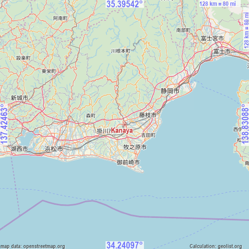
Kanaya GPS coordinates[2]
34° 49' 12.792" North, 138° 7' 39.9" East
| Map corner | latitude | longitude |
|---|---|---|
| Upper-left | 35.39542°, | 137.42463° |
| Center: | 34.82022°, | 138.12775° |
| Lower-right: | 34.24097°, | 138.83088° |
| Map W x H: | 128.4×128.4 km | = 79.8×79.8mi |
| max Lat: | 45.40944° ⇑63.5% North |
| Kanaya: | 34.82022° |
| min Lat: | ⇓36.5% South 24.34478° |
| min Long | Kanaya | max Long |
| 123° | 138.12775° | 145.575° |
| W 54.1%⇐ | ⇒45.9% E |
Elevation
Elevation of Kanaya is 106 m = 348 ft, and this is 21.4 m = 70 ft above average elevation for this country.
| Max E: |
1086 m = 3563 ft | 22.5% |
| Kanaya | 106 m 348 ft | |
| Avg. | 84.6 m = 278 ft | |
Min E: |
-2 m = -7 ft | 77.5% |
See also: Japan elevation on elevation.city.
Geographical zone
Kanaya is located in North temperate zone (between Tropic of Cancer and the Arctic Circle). Distance of this Northern Tropic circle is 1265.7 km =786.5 mi to South.| Distance of | km | miles | from Kanaya |
|---|---|---|---|
| North Pole | 6135.4 | 3812.4 | to North |
| Arctic Circle | 3529.5 | 2193.1 | to North |
| Tropic Cancer | 1265.7 | 786.5 | to South |
| Equator | 3871.6 | 2405.7 | to South |


Nearby cities:
15 places around Kanaya: (largest is in red/bold)
• Fujieda
13.7 km =8.5 mi,  67°
67°
• Fukuroi
20.8 km =12.9 mi,  247°
247°
• Hamakita
31.5 km =19.6 mi,  265°
265°
• Handayama
36 km =22.4 mi,  261°
261°
• Iwata
28.7 km =17.8 mi,  242°
242°
• Kakegawa
11.8 km =7.3 mi, 239°
• Kikugawa
13.1 km =8.1 mi,  183°
183°
• Makinohara
5.4 km =3.4 mi,  159°
159°
• Mori
17.8 km =11.1 mi, 274°
• Omaezaki
26 km =16.2 mi, 161°
• Sagara
16.6 km =10.3 mi,  154°
154°
• Shimada
5.1 km =3.2 mi,  94°
94°
• Shizuoka
29.5 km =18.3 mi,  52°
52°
• Yaizu
18.3 km =11.4 mi, 72°
• Ōyama
25.4 km =15.8 mi, 161°
Sources, notices
• [Note1] Compared only with cities in Japan existing in our database
• [Src1] Map data: © OpenStreetMap contributors (CC-BY-SA)
• [Src2] Other city data from geonames.org with taken over terms of usage.
• [Src3] Geographical zone / Annual Mean Temperature by Robert A. Rohde @ Wikipedia
