Kamirenjaku geodata
Kamirenjaku (Tokyo) is a section of populated place; located in Japan in Asia/Tokyo (GMT+9) time zone. With population of 178,739 people, there are 114 cities with bigger population in this country. Compared to other cities in Japan, 57.8% of cities are located further ↓South; 70.3% of cities are located further ←West and 65.9% of cities have lower elevation than Kamirenjaku. Note1


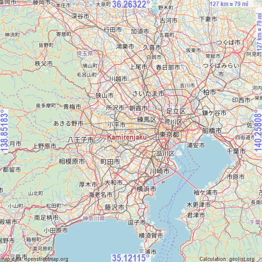
Kamirenjaku GPS coordinates[2]
35° 41' 39.228" North, 139° 33' 17.82" East
| Map corner | latitude | longitude |
|---|---|---|
| Upper-left | 36.26322°, | 138.85183° |
| Center: | 35.69423°, | 139.55495° |
| Lower-right: | 35.12115°, | 140.25808° |
| Map W x H: | 127×127 km | = 78.9×78.9mi |
| max Lat: | 45.40944° ⇑42.2% North |
| Kamirenjaku: | 35.69423° |
| min Lat: | ⇓57.8% South 24.34478° |
| min Long | Kamirenjaku | max Long |
| 123° | 139.55495° | 145.575° |
| W 70.3%⇐ | ⇒29.7% E |
Elevation
Elevation of Kamirenjaku is 59 m = 194 ft, and this is 25.6 m = 84 ft below average elevation for this country.
| Max E: |
1086 m = 3563 ft | 34.1% |
| Avg. | 84.6 m = 278 ft | |
| Kamirenjaku | 59 m = 194 ft | |
Min E: |
-2 m = -7 ft | 65.9% |
See also: Kamirenjaku elevation on elevation.city.
Geographical zone
Kamirenjaku is located in North temperate zone (between Tropic of Cancer and the Arctic Circle). Distance of this Northern Tropic circle is 1362.9 km =846.9 mi to South.| Distance of | km | miles | from Kamirenjaku |
|---|---|---|---|
| North Pole | 6038.2 | 3752 | to North |
| Arctic Circle | 3432.3 | 2132.7 | to North |
| Tropic Cancer | 1362.9 | 846.9 | to South |
| Equator | 3968.8 | 2466.1 | to South |


Nearby cities:
15 places around Kamirenjaku: (largest is in red/bold)
• Chōfu
3.9 km =2.4 mi,  188°
188°
• Fuchū
6.9 km =4.3 mi,  251°
251°
• Higashikurume
7.5 km =4.7 mi,  328°
328°
• Inagi
8.4 km =5.2 mi,  216°
216°
• Kiyose
9.7 km =6 mi,  346°
346°
• Kodaira
7.2 km =4.5 mi,  299°
299°
• Koganei
4 km =2.5 mi,  279°
279°
• Kokubunji
7.2 km =4.5 mi, 277°
• Komae
6.9 km =4.3 mi,  164°
164°
• Mitaka
1.3 km =0.8 mi, 158°
• Musashino
1.4 km =0.9 mi,  17°
17°
• Nishi-Tokyo-shi
3.8 km =2.4 mi,  336°
336°
• Nishitōkyō
4.4 km =2.7 mi, 351°
• Tama
9.6 km =6 mi,  234°
234°
• Tanashichō
4.2 km =2.6 mi, 338°
Sources, notices
• [Note1] Compared only with cities in Japan existing in our database
• [Src1] Map data: © OpenStreetMap contributors (CC-BY-SA)
• [Src2] Other city data from geonames.org with taken over terms of usage.
• [Src3] Geographical zone / Annual Mean Temperature by Robert A. Rohde @ Wikipedia
