Simcheon geodata
Simcheon (North Chungcheong) is a seat of a third-order administrative division; located in South Korea in Asia/Seoul (GMT+9) time zone. In our database, there are 128 cities with bigger population. Compared to other cities in South Korea, 56.6% of cities are located further ↓South; 71% of cities are located further ←West and 75.2% of cities have lower elevation than Simcheon. Note1


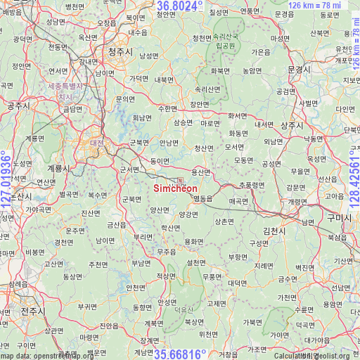
Simcheon GPS coordinates[2]
36° 14' 14.424" North, 127° 43' 20.928" East
| Map corner | latitude | longitude |
|---|---|---|
| Upper-left | 36.8024°, | 127.01936° |
| Center: | 36.23734°, | 127.72248° |
| Lower-right: | 35.66816°, | 128.42561° |
| Map W x H: | 126.1×126.1 km | = 78.4×78.4mi |
| max Lat: | 38.37881° ⇑43.4% North |
| Simcheon: | 36.23734° |
| min Lat: | ⇓56.6% South 33.25333° |
| min Long | Simcheon | max Long |
| 126.10863° | 127.72248° | 129.55377° |
| W 71%⇐ | ⇒29% E |
Elevation
Elevation of Simcheon is 93 m = 305 ft, and this is 22.6 m = 74 ft above average elevation for this country.
| Max E: |
691 m = 2267 ft | 24.8% |
| Simcheon | 93 m 305 ft | |
| Avg. | 70.4 m = 231 ft | |
Min E: |
1 m = 3 ft | 75.2% |
See also: South Korea elevation on elevation.city.
Geographical zone
Simcheon is located in North temperate zone (between Tropic of Cancer and the Arctic Circle). Distance of this Northern Tropic circle is 1423.3 km =884.4 mi to South.| Distance of | km | miles | from Simcheon |
|---|---|---|---|
| North Pole | 5977.8 | 3714.4 | to North |
| Arctic Circle | 3372 | 2095.3 | to North |
| Tropic Cancer | 1423.3 | 884.4 | to South |
| Equator | 4029.2 | 2503.6 | to South |


Nearby cities:
15 places around Simcheon: (largest is in red/bold)
• Annae
18.3 km =11.4 mi,  342°
342°
• Annam
14 km =8.7 mi, 341°
• Cheongsan
13.7 km =8.5 mi,  27°
27°
• Cheongseong
10.5 km =6.5 mi,  18°
18°
• Chupungnyeong
24.3 km =15.1 mi,  95°
95°
• Dongi
10.6 km =6.6 mi,  299°
299°
• Gunbuk
19.1 km =11.9 mi,  246°
246°
• Gunbuk
19.8 km =12.3 mi, 301°
• Gunseo
18.1 km =11.2 mi,  284°
284°
• Hwanggan
16.7 km =10.4 mi,  91°
91°
• Iwon
9.3 km =5.8 mi, 276°
• Okcheon
15.6 km =9.7 mi, 297°
• Samseung
17.8 km =11.1 mi,  2°
2°
• Yeongdong
8.5 km =5.3 mi,  145°
145°
• Yongsan
9.8 km =6.1 mi,  74°
74°
Sources, notices
• [Note1] Compared only with cities in South Korea existing in our database
• [Src1] Map data: © OpenStreetMap contributors (CC-BY-SA)
• [Src2] Other city data from geonames.org with taken over terms of usage.
• [Src3] Geographical zone / Annual Mean Temperature by Robert A. Rohde @ Wikipedia
