Ambatolampy geodata
Ambatolampy (Vakinankaratra) is a populated place; located in Madagascar in Indian/Antananarivo (GMT+3) time zone. With population of 28,461 people, there are 36 cities with bigger population in this country. Compared to other cities in Madagascar, 53.7% of cities are located further ↑North; 56.1% of cities are located further →East and 97.6% of cities have lower elevation than Ambatolampy. Note1
Administrative division(s):
- Level 1: Vakinankaratra
- Level 2: Ambatolampy
- Level 3: Ambatolampy
- Level 4: Ambodiriana


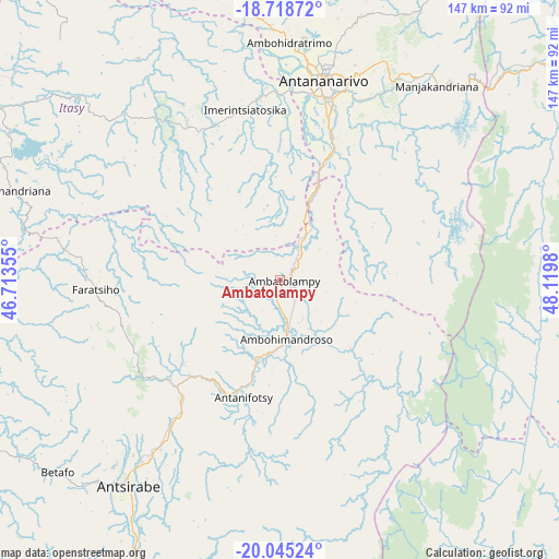
Ambatolampy GPS coordinates[2]
19° 22' 59.988" South, 47° 25' 0.012" East
| Map corner | latitude | longitude |
|---|---|---|
| Upper-left | -18.71872°, | 46.71355° |
| Center: | -19.38333°, | 47.41667° |
| Lower-right: | -20.04524°, | 48.1198° |
| Map W x H: | 147.5×147.5 km | = 91.7×91.7mi |
| max Lat: | -12.31732° ⇑53.7% North |
| Ambatolampy: | -19.38333° |
| min Lat: | ⇓46.3% South -25.3° |
| min Long | Ambatolampy | max Long |
| 43.65° | 47.41667° | 50.27876° |
| W 43.9%⇐ | ⇒56.1% E |
Elevation
Elevation of Ambatolampy is 1586 m = 5203 ft, and this is 1028.6 m = 3375 ft above average elevation for this country.
| Max E: |
1763 m = 5784 ft | 2.4% |
| Ambatolampy | 1586 m 5203 ft | |
| Avg. | 557.4 m = 1829 ft | |
Min E: |
1 m = 3 ft | 97.6% |
See also: Madagascar elevation on elevation.city.
Geographical zone
Ambatolampy is located in South Torrid zone (between Equator and Tropic of Capricorn). Distance of this Southern Tropic circle is 450.7 km =280.1 mi to South.| Distance of | km | miles | from Ambatolampy |
|---|---|---|---|
| Equator | 2155.2 | 1339.2 | to North |
| Tropic Capricorn | 450.7 | 280.1 | to South |
| Antarctic Circle | 5245.9 | 3259.7 | to South |
| South Pole | 7851.8 | 4878.9 | to South |


Nearby cities:
15 places around Ambatolampy: (largest is in red/bold)
• Alarobia
57 km =35.4 mi,  35°
35°
• Ambohitrandriamanitra
50.9 km =31.6 mi,  49°
49°
• Andramasina
28.4 km =17.6 mi, 39°
• Antananarivo
53.7 km =33.4 mi,  13°
13°
• Antanifotsy
31.4 km =19.5 mi,  199°
199°
• Antsampanimahazo
39.5 km =24.5 mi,  223°
223°
• Arivonimamo
47.6 km =29.6 mi,  328°
328°
• Faratsiho
49 km =30.4 mi,  267°
267°
• Manjakandriana
65.7 km =40.8 mi, 37°
• Mantasoa
59.8 km =37.2 mi, 47°
• Merikanjaka
53.3 km =33.1 mi,  58°
58°
• Miadanandriana
54.7 km =34 mi, 44°
• Nandihizana
62.3 km =38.7 mi,  30°
30°
• Sambaina
66.1 km =41.1 mi, 35°
• Soanindrariny
60.6 km =37.7 mi, 198°
Sources, notices
• [Note1] Compared only with cities in Madagascar existing in our database
• [Src1] Map data: © OpenStreetMap contributors (CC-BY-SA)
• [Src2] Other city data from geonames.org with taken over terms of usage.
• [Src3] Geographical zone / Annual Mean Temperature by Robert A. Rohde @ Wikipedia
