Munxar geodata
Munxar (Il-Munxar) is a seat of a first-order administrative division; located in Malta in Europe/Malta (GMT+2) time zone. With population of 840 people, there are 65 cities with bigger population in this country. Compared to other cities in Malta, 81.7% of cities are located further ↓South; 91.5% of cities are located further →East and 59.2% of cities have lower elevation than Munxar. Note1


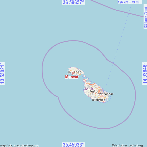
Munxar GPS coordinates[2]
36° 1' 48" North, 14° 13' 59.988" East
| Map corner | latitude | longitude |
|---|---|---|
| Upper-left | 36.59657°, | 13.53021° |
| Center: | 36.03°, | 14.23333° |
| Lower-right: | 35.45933°, | 14.93646° |
| Map W x H: | 126.4×126.4 km | = 78.5×78.5mi |
| max Lat: | 36.07222° ⇑18.3% North |
| Munxar: | 36.03° |
| min Lat: | ⇓81.7% South 35.82583° |
| min Long | Munxar | max Long |
| 14.20361° | 14.23333° | 14.56701° |
| W 8.5%⇐ | ⇒91.5% E |
Elevation
Elevation of Munxar is 80 m = 262 ft, and this is 1.9 m = 6 ft above average elevation for this country.
| Max E: |
231 m = 758 ft | 40.8% |
| Munxar | 80 m 262 ft | |
| Avg. | 78.1 m = 256 ft | |
Min E: |
5 m = 16 ft | 59.2% |
See also: Malta elevation on elevation.city.
Geographical zone
Munxar is located in North temperate zone (between Tropic of Cancer and the Arctic Circle). Distance of this Northern Tropic circle is 1400.2 km =870 mi to South.| Distance of | km | miles | from Munxar |
|---|---|---|---|
| North Pole | 6000.9 | 3728.8 | to North |
| Arctic Circle | 3395 | 2109.6 | to North |
| Tropic Cancer | 1400.2 | 870 | to South |
| Equator | 4006.2 | 2489.3 | to South |


Nearby cities:
15 places around Munxar: (largest is in red/bold)
• Fontana
0.9 km =0.6 mi,  16°
16°
• Għajnsielem
4.7 km =2.9 mi,  94°
94°
• Għammar
4.2 km =2.6 mi,  341°
341°
• Għarb
4 km =2.5 mi,  326°
326°
• Għasri
3.2 km =2 mi,  348°
348°
• Kerċem
1.5 km =0.9 mi, 335°
• Mġarr
5.6 km =3.5 mi,  95°
95°
• Nadur
5.5 km =3.4 mi,  81°
81°
• Saint Lucia
2.1 km =1.3 mi,  315°
315°
• San Lawrenz
3.9 km =2.4 mi, 316°
• Sannat
1.1 km =0.7 mi,  126°
126°
• Victoria
1.7 km =1.1 mi, 19°
• Xagħra
3.6 km =2.2 mi,  51°
51°
• Xewkija
2.2 km =1.4 mi, 82°
• Żebbuġ
4.7 km =2.9 mi,  2°
2°
Sources, notices
• [Note1] Compared only with cities in Malta existing in our database
• [Src1] Map data: © OpenStreetMap contributors (CC-BY-SA)
• [Src2] Other city data from geonames.org with taken over terms of usage.
• [Src3] Geographical zone / Annual Mean Temperature by Robert A. Rohde @ Wikipedia
