Zacualpan geodata
Zacualpan (Veracruz) is a seat of a second-order administrative division; located in Mexico in America/Mexico_City (GMT-6) time zone. With population of 633 people, there are 13682 cities with bigger population in this country. Compared to other cities in Mexico, 66.4% of cities are located further ↓South; 59.3% of cities are located further ←West and 58% of cities have lower elevation than Zacualpan. Note1


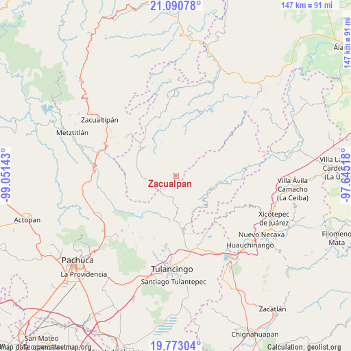
Zacualpan GPS coordinates[2]
20° 25' 59.952" North, 98° 20' 53.88" West
| Map corner | latitude | longitude |
|---|---|---|
| Upper-left | 21.09078°, | -99.05143° |
| Center: | 20.43332°, | -98.3483° |
| Lower-right: | 19.77304°, | -97.64518° |
| Map W x H: | 146.5×146.5 km | = 91×91mi |
| max Lat: | 32.7° ⇑33.6% North |
| Zacualpan: | 20.43332° |
| min Lat: | ⇓66.4% South 14.53588° |
| min Long | Zacualpan | max Long |
| -117.105° | -98.3483° | -86.73105° |
| W 59.3%⇐ | ⇒40.7% E |
Elevation
Elevation of Zacualpan is 1691 m = 5548 ft, and this is 437.3 m = 1435 ft above average elevation for this country.
| Max E: |
3497 m = 11473 ft | 42% |
| Zacualpan | 1691 m 5548 ft | |
| Avg. | 1253.7 m = 4113 ft | |
Min E: |
-1 m = -3 ft | 58% |
See also: Mexico elevation on elevation.city.
Geographical zone
Zacualpan is located in North Torrid zone (between Equator and Tropic of Cancer). Distance of this Northern Tropic circle is 333.9 km =207.5 mi to North.| Distance of | km | miles | from Zacualpan |
|---|---|---|---|
| North Pole | 7735.1 | 4806.4 | to North |
| Arctic Circle | 5129.2 | 3187.1 | to North |
| Tropic Cancer | 333.9 | 207.5 | to North |
| Equator | 2272 | 1411.8 | to South |


Nearby cities:
15 places around Zacualpan: (largest is in red/bold)
• Carbonero Jacales
12.9 km =8 mi,  263°
263°
• Chichicaxtle
7.6 km =4.7 mi,  201°
201°
• Colonia Industrial
16.2 km =10.1 mi,  100°
100°
• Colonia San José
16.3 km =10.1 mi,  131°
131°
• Ejido de Agua Blanca (Cerro Alto)
12.3 km =7.6 mi,  191°
191°
• Estación de Apulco
16.4 km =10.2 mi,  179°
179°
• Ferrería de Apulco
14.5 km =9 mi, 178°
• Palo Bendito
16 km =9.9 mi,  279°
279°
• Palo Hueco
11.2 km =7 mi,  272°
272°
• San Bartolo Tutotepec
15.9 km =9.9 mi, 104°
• Santa María Temaxcalapa
16.7 km =10.4 mi,  110°
110°
• Tenango de Doria
16.4 km =10.2 mi, 130°
• Texcatepec
17 km =10.6 mi,  353°
353°
• Teximalpa
17.6 km =10.9 mi, 262°
• Valle Verde
16.3 km =10.1 mi, 102°
Sources, notices
• [Note1] Compared only with cities in Mexico existing in our database
• [Src1] Map data: © OpenStreetMap contributors (CC-BY-SA)
• [Src2] Other city data from geonames.org with taken over terms of usage.
• [Src3] Geographical zone / Annual Mean Temperature by Robert A. Rohde @ Wikipedia
