Tlacolula de Matamoros geodata
Tlacolula de Matamoros (Oaxaca) is a seat of a second-order administrative division; located in Mexico in America/Mexico_City (GMT-6) time zone. With population of 13,821 people, there are 704 cities with bigger population in this country. Compared to other cities in Mexico, 89.5% of cities are located further ↑North; 79.8% of cities are located further ←West and 56.2% of cities have lower elevation than Tlacolula de Matamoros. Note1


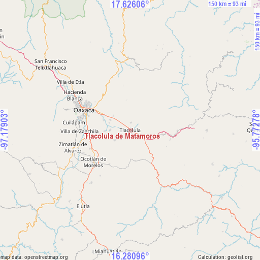
Tlacolula de Matamoros GPS coordinates[2]
16° 57' 16.956" North, 96° 28' 33.24" West
| Map corner | latitude | longitude |
|---|---|---|
| Upper-left | 17.62606°, | -97.17903° |
| Center: | 16.95471°, | -96.4759° |
| Lower-right: | 16.28096°, | -95.77278° |
| Map W x H: | 149.6×149.6 km | = 93×93mi |
| max Lat: | 32.7° ⇑89.5% North |
| Tlacolula de Matamoros: | 16.95471° |
| min Lat: | ⇓10.5% South 14.53588° |
| min Long | Tlacolula de Ma | max Long |
| -117.105° | -96.4759° | -86.73105° |
| W 79.8%⇐ | ⇒20.2% E |
Elevation
Elevation of Tlacolula de Matamoros is 1625 m = 5331 ft, and this is 371.3 m = 1218 ft above average elevation for this country.
| Max E: |
3497 m = 11473 ft | 43.8% |
| Tlacolula de Matamoros | 1625 m 5331 ft | |
| Avg. | 1253.7 m = 4113 ft | |
Min E: |
-1 m = -3 ft | 56.2% |
See also: Mexico elevation on elevation.city.
Geographical zone
Tlacolula de Matamoros is located in North Torrid zone (between Equator and Tropic of Cancer). Distance of this Northern Tropic circle is 720.7 km =447.8 mi to North.| Distance of | km | miles | from Tlacolula de Matamoros |
|---|---|---|---|
| North Pole | 8121.9 | 5046.7 | to North |
| Arctic Circle | 5516 | 3427.5 | to North |
| Tropic Cancer | 720.7 | 447.8 | to North |
| Equator | 1885.2 | 1171.4 | to South |


Nearby cities:
15 places around Tlacolula de Matamoros: (largest is in red/bold)
• Fraccionamiento Ciudad Yagul
2.9 km =1.8 mi,  30°
30°
• Fraccionamiento Rancho Valle del Lago
3.7 km =2.3 mi,  305°
305°
• Macuilxóchitl de Artigas Carranza
9.6 km =6 mi, 314°
• Magdalena Teitipac
10.4 km =6.5 mi,  237°
237°
• San Bartolomé Quialana
6.4 km =4 mi,  205°
205°
• San Juan Guelavía
7.2 km =4.5 mi,  270°
270°
• San Lucas Quiavini
6.6 km =4.1 mi,  172°
172°
• San Marcos Tlapazola
7 km =4.3 mi,  226°
226°
• San Miguel del Valle
9.6 km =6 mi,  40°
40°
• San Sebastián Abasolo
12.6 km =7.8 mi,  290°
290°
• Santa Ana del Valle
4.5 km =2.8 mi,  6°
6°
• Santa Cruz Papalutla
11.4 km =7.1 mi, 270°
• Teotitlán del Valle
9.5 km =5.9 mi,  331°
331°
• Unión Zapata
7.9 km =4.9 mi,  121°
121°
• Villa Díaz Ordaz
6.5 km =4 mi,  45°
45°
Sources, notices
• [Note1] Compared only with cities in Mexico existing in our database
• [Src1] Map data: © OpenStreetMap contributors (CC-BY-SA)
• [Src2] Other city data from geonames.org with taken over terms of usage.
• [Src3] Geographical zone / Annual Mean Temperature by Robert A. Rohde @ Wikipedia
