San Miguel del Valle geodata
San Miguel del Valle (Oaxaca) is a populated place; located in Mexico in America/Mexico_City (GMT-6) time zone. With population of 2,818 people, there are 3149 cities with bigger population in this country. Compared to other cities in Mexico, 88.6% of cities are located further ↑North; 80.1% of cities are located further ←West and 63.2% of cities have lower elevation than San Miguel del Valle. Note1
Current local time in San Miguel del Valle:
08:35 AM, WednesdayDifference from your time zone: hours


San Miguel del Valle GPS coordinates[2]
17° 1' 14.988" North, 96° 25' 2.172" West
| Map corner | latitude | longitude |
|---|---|---|
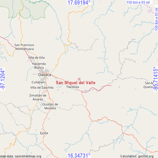
| Upper-left | 17.69194°, | -97.1204° |
| Center: | 17.02083°, | -96.41727° |
| Lower-right: | 16.34731°, | -95.71415° |
| Map W x H: | 149.5×149.5 km | = 92.9×92.9mi |
| max Lat: | 32.7° ⇑88.6% North |
| San Miguel del Valle: | 17.02083° |
| min Lat: | ⇓11.4% South 14.53588° |
| min Long | San Miguel del | max Long |
| -117.105° | -96.41727° | -86.73105° |
| W 80.1%⇐ | ⇒19.9% E |
Elevation
Elevation of San Miguel del Valle is 1782 m = 5846 ft, and this is 528.3 m = 1733 ft above average elevation for this country.
| Max E: |
3497 m = 11473 ft | 36.8% |
| San Miguel del Valle | 1782 m 5846 ft | |
| Avg. | 1253.7 m = 4113 ft | |
Min E: |
-1 m = -3 ft | 63.2% |
See also: Mexico elevation on elevation.city.
Geographical zone
San Miguel del Valle is located in North Torrid zone (between Equator and Tropic of Cancer). Distance of this Northern Tropic circle is 713.4 km =443.3 mi to North.| Distance of | km | miles | from San Miguel del Valle |
|---|---|---|---|
| North Pole | 8114.5 | 5042.1 | to North |
| Arctic Circle | 5508.6 | 3422.9 | to North |
| Tropic Cancer | 713.4 | 443.3 | to North |
| Equator | 1892.5 | 1175.9 | to South |


Nearby cities:
15 places around San Miguel del Valle: (largest is in red/bold)
• Fraccionamiento Ciudad Yagul
6.8 km =4.2 mi,  224°
224°
• Fraccionamiento Rancho Valle del Lago
10.6 km =6.6 mi,  240°
240°
• Macuilxóchitl de Artigas Carranza
13.1 km =8.1 mi,  267°
267°
• San Antonio Cuajimoloyas
11.5 km =7.1 mi,  341°
341°
• San Bartolomé Quialana
15.9 km =9.9 mi,  214°
214°
• San Juan Guelavía
15.3 km =9.5 mi, 241°
• San Lucas Quiavini
14.9 km =9.3 mi,  201°
201°
• San Pablo Villa de Mitla
12.5 km =7.8 mi,  150°
150°
• Santa Ana del Valle
6.4 km =4 mi, 243°
• Santiago Ixtaltepec
15.8 km =9.8 mi, 273°
• Teotitlán del Valle
10.9 km =6.8 mi,  275°
275°
• Tlacolula de Matamoros
9.6 km =6 mi, 220°
• Unión Zapata
11.4 km =7.1 mi,  177°
177°
• Villa Díaz Ordaz
3.2 km =2 mi, 209°
• Xaaga
16.1 km =10 mi,  143°
143°
Sources, notices
• [Note1] Compared only with cities in Mexico existing in our database
• [Src1] Map data: © OpenStreetMap contributors (CC-BY-SA)
• [Src2] Other city data from geonames.org with taken over terms of usage.
• [Src3] Geographical zone / Annual Mean Temperature by Robert A. Rohde @ Wikipedia
