San Sebastián Tecomaxtlahuaca geodata
San Sebastián Tecomaxtlahuaca (Oaxaca) is a populated place; located in Mexico in America/Mexico_City (GMT-6) time zone. With population of 2,402 people, there are 3675 cities with bigger population in this country. Compared to other cities in Mexico, 84.7% of cities are located further ↑North; 63.2% of cities are located further ←West and 58.9% of cities have lower elevation than San Sebastián Tecomaxtlahuaca. Note1
Current local time in San Sebastián Tecomaxtlahuaca:
11:16 AM, MondayDifference from your time zone: hours


San Sebastián Tecomaxtlahuaca GPS coordinates[2]
17° 20' 49.956" North, 98° 1' 54.012" West
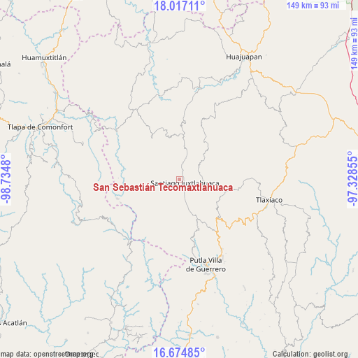
| Map corner | latitude | longitude |
|---|---|---|
| Upper-left | 18.01711°, | -98.7348° |
| Center: | 17.34721°, | -98.03167° |
| Lower-right: | 16.67485°, | -97.32855° |
| Map W x H: | 149.2×149.2 km | = 92.7×92.7mi |
| max Lat: | 32.7° ⇑84.7% North |
| San Sebastián Tecomaxtlahuaca: | 17.34721° |
| min Lat: | ⇓15.3% South 14.53588° |
| min Long | San Sebastián | max Long |
| -117.105° | -98.03167° | -86.73105° |
| W 63.2%⇐ | ⇒36.8% E |
Elevation
Elevation of San Sebastián Tecomaxtlahuaca is 1706 m = 5597 ft, and this is 452.3 m = 1484 ft above average elevation for this country.
| Max E: |
3497 m = 11473 ft | 41.1% |
| San Sebastián Tecomaxtlahuaca | 1706 m 5597 ft | |
| Avg. | 1253.7 m = 4113 ft | |
Min E: |
-1 m = -3 ft | 58.9% |
See also: Mexico elevation on elevation.city.
Geographical zone
San Sebastián Tecomaxtlahuaca is located in North Torrid zone (between Equator and Tropic of Cancer). Distance of this Northern Tropic circle is 677.1 km =420.7 mi to North.| Distance of | km | miles | from San Sebastián Tecomaxtlahuaca |
|---|---|---|---|
| North Pole | 8078.2 | 5019.6 | to North |
| Arctic Circle | 5472.3 | 3400.3 | to North |
| Tropic Cancer | 677.1 | 420.7 | to North |
| Equator | 1928.8 | 1198.5 | to South |


Nearby cities:
15 places around San Sebastián Tecomaxtlahuaca: (largest is in red/bold)
• Ixpantepec Nieves
17.8 km =11.1 mi,  356°
356°
• La Sabana
18.4 km =11.4 mi,  155°
155°
• San Juan Piñas
18.2 km =11.3 mi,  220°
220°
• San Marcos Xinicuesta
11 km =6.8 mi,  237°
237°
• San Miguel Cuevas
11.5 km =7.1 mi,  189°
189°
• San Miguel Tlacotepec
12.4 km =7.7 mi,  12°
12°
• Santa Catarina Noltepec
6.5 km =4 mi,  209°
209°
• Santa María Asunción
12.2 km =7.6 mi, 163°
• Santa María Yucunicoco
17.2 km =10.7 mi,  135°
135°
• Santa Rosa Caxtlahuaca
5.2 km =3.2 mi, 162°
• Santiago Juxtlahuaca
2.6 km =1.6 mi,  123°
123°
• Santiago Naranjos
9.1 km =5.7 mi,  165°
165°
• Santiago Nuxaño
6.7 km =4.2 mi,  17°
17°
• Santos Reyes Tepejillo
14.1 km =8.8 mi,  44°
44°
• Santos Reyes Zochiquilazola
18.5 km =11.5 mi, 240°
Sources, notices
• [Note1] Compared only with cities in Mexico existing in our database
• [Src1] Map data: © OpenStreetMap contributors (CC-BY-SA)
• [Src2] Other city data from geonames.org with taken over terms of usage.
• [Src3] Geographical zone / Annual Mean Temperature by Robert A. Rohde @ Wikipedia
