San Miguel Tlacotepec geodata
San Miguel Tlacotepec (Oaxaca) is a populated place; located in Mexico in America/Mexico_City (GMT-6) time zone. With population of 1,621 people, there are 5339 cities with bigger population in this country. Compared to other cities in Mexico, 83.6% of cities are located further ↑North; 63.6% of cities are located further ←West and 60.5% of cities have lower elevation than San Miguel Tlacotepec. Note1


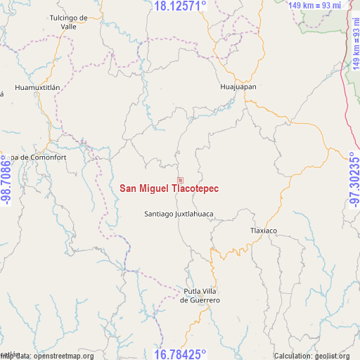
San Miguel Tlacotepec GPS coordinates[2]
17° 27' 22.356" North, 98° 0' 19.692" West
| Map corner | latitude | longitude |
|---|---|---|
| Upper-left | 18.12571°, | -98.7086° |
| Center: | 17.45621°, | -98.00547° |
| Lower-right: | 16.78425°, | -97.30235° |
| Map W x H: | 149.2×149.2 km | = 92.7×92.7mi |
| max Lat: | 32.7° ⇑83.6% North |
| San Miguel Tlacotepec: | 17.45621° |
| min Lat: | ⇓16.4% South 14.53588° |
| min Long | San Miguel Tlac | max Long |
| -117.105° | -98.00547° | -86.73105° |
| W 63.6%⇐ | ⇒36.4% E |
Elevation
Elevation of San Miguel Tlacotepec is 1734 m = 5689 ft, and this is 480.3 m = 1576 ft above average elevation for this country.
| Max E: |
3497 m = 11473 ft | 39.5% |
| San Miguel Tlacotepec | 1734 m 5689 ft | |
| Avg. | 1253.7 m = 4113 ft | |
Min E: |
-1 m = -3 ft | 60.5% |
See also: Mexico elevation on elevation.city.
Geographical zone
San Miguel Tlacotepec is located in North Torrid zone (between Equator and Tropic of Cancer). Distance of this Northern Tropic circle is 665 km =413.2 mi to North.| Distance of | km | miles | from San Miguel Tlacotepec |
|---|---|---|---|
| North Pole | 8066.1 | 5012 | to North |
| Arctic Circle | 5460.2 | 3392.8 | to North |
| Tropic Cancer | 665 | 413.2 | to North |
| Equator | 1940.9 | 1206 | to South |


Nearby cities:
15 places around San Miguel Tlacotepec: (largest is in red/bold)
• Ixpantepec Nieves
6.9 km =4.3 mi,  325°
325°
• Peña Colorada
22.5 km =14 mi,  83°
83°
• San Agustín Atenango
17.3 km =10.7 mi,  358°
358°
• San Andrés Yutatío
20.6 km =12.8 mi,  35°
35°
• San Jerónimo Nuchita
22.8 km =14.2 mi,  335°
335°
• San Juan Diquiyu
21.8 km =13.5 mi,  52°
52°
• San Marcos Xinicuesta
21.7 km =13.5 mi,  213°
213°
• San Sebastián Tecomaxtlahuaca
12.4 km =7.7 mi,  192°
192°
• Santa Catarina Noltepec
18.8 km =11.7 mi,  198°
198°
• Santa Rosa Caxtlahuaca
17.1 km =10.6 mi,  184°
184°
• Santiago Juxtlahuaca
13.5 km =8.4 mi, 182°
• Santiago Naranjos
20.9 km =13 mi, 181°
• Santiago Nuxaño
5.8 km =3.6 mi, 187°
• Santos Reyes Tepejillo
7.4 km =4.6 mi,  106°
106°
• Silacayoápam
15.2 km =9.4 mi,  290°
290°
Sources, notices
• [Note1] Compared only with cities in Mexico existing in our database
• [Src1] Map data: © OpenStreetMap contributors (CC-BY-SA)
• [Src2] Other city data from geonames.org with taken over terms of usage.
• [Src3] Geographical zone / Annual Mean Temperature by Robert A. Rohde @ Wikipedia
