San Miguel Peras geodata
San Miguel Peras (Oaxaca) is a populated place; located in Mexico in America/Mexico_City (GMT-6) time zone. With population of 1,169 people, there are 7428 cities with bigger population in this country. Compared to other cities in Mexico, 89.7% of cities are located further ↑North; 74.7% of cities are located further ←West and 77.9% of cities have lower elevation than San Miguel Peras. Note1


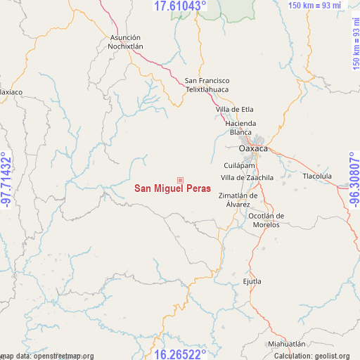
San Miguel Peras GPS coordinates[2]
16° 56' 20.508" North, 97° 0' 40.284" West
| Map corner | latitude | longitude |
|---|---|---|
| Upper-left | 17.61043°, | -97.71432° |
| Center: | 16.93903°, | -97.01119° |
| Lower-right: | 16.26522°, | -96.30807° |
| Map W x H: | 149.6×149.6 km | = 93×93mi |
| max Lat: | 32.7° ⇑89.7% North |
| San Miguel Peras: | 16.93903° |
| min Lat: | ⇓10.3% South 14.53588° |
| min Long | San Miguel Pera | max Long |
| -117.105° | -97.01119° | -86.73105° |
| W 74.7%⇐ | ⇒25.3% E |
Elevation
Elevation of San Miguel Peras is 2086 m = 6844 ft, and this is 832.3 m = 2731 ft above average elevation for this country.
| Max E: |
3497 m = 11473 ft | 22.1% |
| San Miguel Peras | 2086 m 6844 ft | |
| Avg. | 1253.7 m = 4113 ft | |
Min E: |
-1 m = -3 ft | 77.9% |
See also: Mexico elevation on elevation.city.
Geographical zone
San Miguel Peras is located in North Torrid zone (between Equator and Tropic of Cancer). Distance of this Northern Tropic circle is 722.5 km =448.9 mi to North.| Distance of | km | miles | from San Miguel Peras |
|---|---|---|---|
| North Pole | 8123.6 | 5047.8 | to North |
| Arctic Circle | 5517.7 | 3428.5 | to North |
| Tropic Cancer | 722.5 | 448.9 | to North |
| Equator | 1883.4 | 1170.3 | to South |


Nearby cities:
15 places around San Miguel Peras: (largest is in red/bold)
• Duraznal
15 km =9.3 mi,  18°
18°
• El Manzanito Tepantepec
3.9 km =2.4 mi,  326°
326°
• La Lobera
18.7 km =11.6 mi,  87°
87°
• Magdalena Mixtepec
12.1 km =7.5 mi,  112°
112°
• Pensamiento Liberal Mexicano
3.9 km =2.4 mi,  245°
245°
• San Antonio Huitepec
14.5 km =9 mi,  265°
265°
• San Bernardo Mixtepec
17.3 km =10.7 mi,  136°
136°
• San Mateo Mixtepec
18.6 km =11.6 mi,  157°
157°
• San Pablo Cuatro Venados
13.6 km =8.5 mi,  69°
69°
• San Pedro el Alto
15.2 km =9.4 mi,  197°
197°
• Santa Catalina Mixtepec
9 km =5.6 mi,  123°
123°
• Santa Inés del Monte
15.9 km =9.9 mi,  96°
96°
• Santa María Peñoles
15.7 km =9.8 mi,  3°
3°
• Santiago Huaxolotipac
8.9 km =5.5 mi,  295°
295°
• Soledad Peras
8 km =5 mi, 69°
Sources, notices
• [Note1] Compared only with cities in Mexico existing in our database
• [Src1] Map data: © OpenStreetMap contributors (CC-BY-SA)
• [Src2] Other city data from geonames.org with taken over terms of usage.
• [Src3] Geographical zone / Annual Mean Temperature by Robert A. Rohde @ Wikipedia
