San Bernardo Mixtepec geodata
San Bernardo Mixtepec (Oaxaca) is a seat of a second-order administrative division; located in Mexico in America/Mexico_City (GMT-6) time zone. With population of 1,707 people, there are 5091 cities with bigger population in this country. Compared to other cities in Mexico, 91.3% of cities are located further ↑North; 76.1% of cities are located further ←West and 56.8% of cities have lower elevation than San Bernardo Mixtepec. Note1


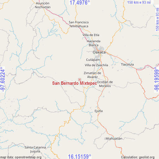
San Bernardo Mixtepec GPS coordinates[2]
16° 49' 32.844" North, 96° 53' 56.796" West
| Map corner | latitude | longitude |
|---|---|---|
| Upper-left | 17.4976°, | -97.60224° |
| Center: | 16.82579°, | -96.89911° |
| Lower-right: | 16.15159°, | -96.19599° |
| Map W x H: | 149.7×149.7 km | = 93×93mi |
| max Lat: | 32.7° ⇑91.3% North |
| San Bernardo Mixtepec: | 16.82579° |
| min Lat: | ⇓8.7% South 14.53588° |
| min Long | San Bernardo Mi | max Long |
| -117.105° | -96.89911° | -86.73105° |
| W 76.1%⇐ | ⇒23.9% E |
Elevation
Elevation of San Bernardo Mixtepec is 1651 m = 5417 ft, and this is 397.3 m = 1303 ft above average elevation for this country.
| Max E: |
3497 m = 11473 ft | 43.2% |
| San Bernardo Mixtepec | 1651 m 5417 ft | |
| Avg. | 1253.7 m = 4113 ft | |
Min E: |
-1 m = -3 ft | 56.8% |
See also: Mexico elevation on elevation.city.
Geographical zone
San Bernardo Mixtepec is located in North Torrid zone (between Equator and Tropic of Cancer). Distance of this Northern Tropic circle is 735.1 km =456.8 mi to North.| Distance of | km | miles | from San Bernardo Mixtepec |
|---|---|---|---|
| North Pole | 8136.2 | 5055.6 | to North |
| Arctic Circle | 5530.3 | 3436.4 | to North |
| Tropic Cancer | 735.1 | 456.8 | to North |
| Equator | 1870.9 | 1162.5 | to South |


Nearby cities:
15 places around San Bernardo Mixtepec: (largest is in red/bold)
• Agua Fría Campanario
9.4 km =5.8 mi,  189°
189°
• Emiliano Zapata
10 km =6.2 mi,  135°
135°
• Magdalena Mixtepec
7.9 km =4.9 mi,  354°
354°
• San José Guelatová de Díaz
12.8 km =8 mi,  108°
108°
• San Mateo Mixtepec
6.6 km =4.1 mi,  225°
225°
• San Miguel Mixtepec
8.2 km =5.1 mi, 228°
• San Pablo Huixtepec
12.6 km =7.8 mi,  93°
93°
• Santa Ana Tlapacoyan
11.3 km =7 mi, 144°
• Santa Catalina Mixtepec
8.8 km =5.5 mi,  330°
330°
• Santa Cruz Mixtepec
4.2 km =2.6 mi,  151°
151°
• Santa Gertrudis
11.4 km =7.1 mi, 112°
• Santa Inés del Monte
11.6 km =7.2 mi,  19°
19°
• Santa María Vigallo
9.5 km =5.9 mi,  68°
68°
• Trapiche Santa Cruz
8.6 km =5.3 mi, 146°
• Valdeflores
10.4 km =6.5 mi,  129°
129°
Sources, notices
• [Note1] Compared only with cities in Mexico existing in our database
• [Src1] Map data: © OpenStreetMap contributors (CC-BY-SA)
• [Src2] Other city data from geonames.org with taken over terms of usage.
• [Src3] Geographical zone / Annual Mean Temperature by Robert A. Rohde @ Wikipedia
