San Miguel Aloápam geodata
San Miguel Aloápam (Oaxaca) is a seat of a second-order administrative division; located in Mexico in America/Mexico_City (GMT-6) time zone. With population of 1,680 people, there are 5169 cities with bigger population in this country. Compared to other cities in Mexico, 84.1% of cities are located further ↑North; 78.5% of cities are located further ←West and 87.7% of cities have lower elevation than San Miguel Aloápam. Note1


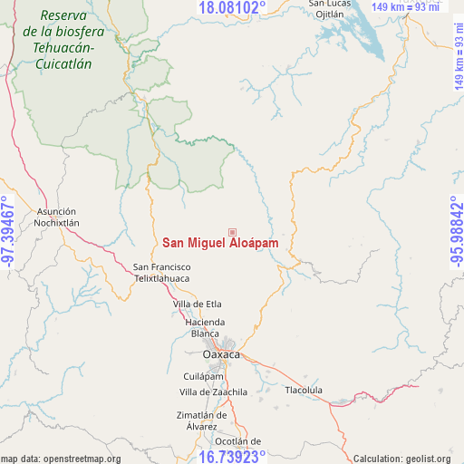
San Miguel Aloápam GPS coordinates[2]
17° 24' 40.896" North, 96° 41' 29.544" West
| Map corner | latitude | longitude |
|---|---|---|
| Upper-left | 18.08102°, | -97.39467° |
| Center: | 17.41136°, | -96.69154° |
| Lower-right: | 16.73923°, | -95.98842° |
| Map W x H: | 149.2×149.2 km | = 92.7×92.7mi |
| max Lat: | 32.7° ⇑84.1% North |
| San Miguel Aloápam: | 17.41136° |
| min Lat: | ⇓15.9% South 14.53588° |
| min Long | San Miguel Alo� | max Long |
| -117.105° | -96.69154° | -86.73105° |
| W 78.5%⇐ | ⇒21.5% E |
Elevation
Elevation of San Miguel Aloápam is 2330 m = 7644 ft, and this is 1076.3 m = 3531 ft above average elevation for this country.
| Max E: |
3497 m = 11473 ft | 12.3% |
| San Miguel Aloápam | 2330 m 7644 ft | |
| Avg. | 1253.7 m = 4113 ft | |
Min E: |
-1 m = -3 ft | 87.7% |
See also: Mexico elevation on elevation.city.
Geographical zone
San Miguel Aloápam is located in North Torrid zone (between Equator and Tropic of Cancer). Distance of this Northern Tropic circle is 670 km =416.3 mi to North.| Distance of | km | miles | from San Miguel Aloápam |
|---|---|---|---|
| North Pole | 8071.1 | 5015.1 | to North |
| Arctic Circle | 5465.2 | 3395.9 | to North |
| Tropic Cancer | 670 | 416.3 | to North |
| Equator | 1936 | 1203 | to South |


Nearby cities:
15 places around San Miguel Aloápam: (largest is in red/bold)
• Atatlahuaca
20 km =12.4 mi,  313°
313°
• El Porvenir
18 km =11.2 mi,  316°
316°
• San Isidro Aloápam
4.4 km =2.7 mi,  54°
54°
• San Juan Atepec
16.2 km =10.1 mi,  83°
83°
• San Juan Bautista Guelache
22.2 km =13.8 mi,  204°
204°
• San Juan Bautista Jayacatlán
14 km =8.7 mi,  275°
275°
• San Juan Luvina
18.3 km =11.4 mi,  55°
55°
• San Juan del Estado
19 km =11.8 mi,  216°
216°
• San Miguel Abejones
9.2 km =5.7 mi,  72°
72°
• San Pablo Macuiltianguis
20.1 km =12.5 mi, 47°
• Santa Ana Yaremi
8.6 km =5.3 mi,  101°
101°
• Santa Catarina Ixtepeji
21 km =13 mi,  139°
139°
• Santa Martha Etla
21.7 km =13.5 mi,  214°
214°
• Santa María Jaltianguis
18.1 km =11.2 mi,  107°
107°
• Teococuilco de Marcos Pérez
10.4 km =6.5 mi,  128°
128°
Sources, notices
• [Note1] Compared only with cities in Mexico existing in our database
• [Src1] Map data: © OpenStreetMap contributors (CC-BY-SA)
• [Src2] Other city data from geonames.org with taken over terms of usage.
• [Src3] Geographical zone / Annual Mean Temperature by Robert A. Rohde @ Wikipedia
