San Miguel Abejones geodata
San Miguel Abejones (Oaxaca) is a populated place; located in Mexico in America/Mexico_City (GMT-6) time zone. With population of 1,009 people, there are 8636 cities with bigger population in this country. Compared to other cities in Mexico, 83.8% of cities are located further ↑North; 79.1% of cities are located further ←West and 84.9% of cities have lower elevation than San Miguel Abejones. Note1


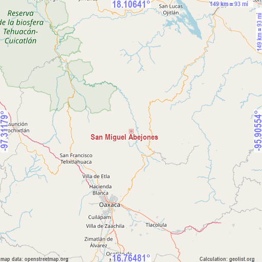
San Miguel Abejones GPS coordinates[2]
17° 26' 12.624" North, 96° 36' 31.176" West
| Map corner | latitude | longitude |
|---|---|---|
| Upper-left | 18.10641°, | -97.31179° |
| Center: | 17.43684°, | -96.60866° |
| Lower-right: | 16.76481°, | -95.90554° |
| Map W x H: | 149.2×149.2 km | = 92.7×92.7mi |
| max Lat: | 32.7° ⇑83.8% North |
| San Miguel Abejones: | 17.43684° |
| min Lat: | ⇓16.2% South 14.53588° |
| min Long | San Miguel Abej | max Long |
| -117.105° | -96.60866° | -86.73105° |
| W 79.1%⇐ | ⇒20.9% E |
Elevation
Elevation of San Miguel Abejones is 2257 m = 7405 ft, and this is 1003.3 m = 3292 ft above average elevation for this country.
| Max E: |
3497 m = 11473 ft | 15.1% |
| San Miguel Abejones | 2257 m 7405 ft | |
| Avg. | 1253.7 m = 4113 ft | |
Min E: |
-1 m = -3 ft | 84.9% |
See also: Mexico elevation on elevation.city.
Geographical zone
San Miguel Abejones is located in North Torrid zone (between Equator and Tropic of Cancer). Distance of this Northern Tropic circle is 667.1 km =414.5 mi to North.| Distance of | km | miles | from San Miguel Abejones |
|---|---|---|---|
| North Pole | 8068.3 | 5013.4 | to North |
| Arctic Circle | 5462.4 | 3394.2 | to North |
| Tropic Cancer | 667.1 | 414.5 | to North |
| Equator | 1938.8 | 1204.7 | to South |


Nearby cities:
15 places around San Miguel Abejones: (largest is in red/bold)
• Guelatao de Juárez
17.8 km =11.1 mi,  137°
137°
• Ixtlán de Juárez
17.3 km =10.7 mi,  132°
132°
• San Isidro Aloápam
5.2 km =3.2 mi,  266°
266°
• San Juan Atepec
7.4 km =4.6 mi,  97°
97°
• San Juan Bautista Jayacatlán
22.8 km =14.2 mi, 266°
• San Juan Luvina
9.8 km =6.1 mi,  39°
39°
• San Juan Quiotepec
18.5 km =11.5 mi,  7°
7°
• San Miguel Aloápam
9.2 km =5.7 mi,  252°
252°
• San Pablo Macuiltianguis
12.3 km =7.6 mi,  29°
29°
• San Pedro Yólox
17.9 km =11.1 mi,  19°
19°
• Santa Ana Yaremi
4.5 km =2.8 mi,  183°
183°
• Santa Catarina Ixtepeji
19.4 km =12.1 mi,  165°
165°
• Santa María Jaltianguis
11.8 km =7.3 mi, 133°
• Santiago Comaltepec
15.7 km =9.8 mi, 23°
• Teococuilco de Marcos Pérez
9.4 km =5.8 mi, 184°
Sources, notices
• [Note1] Compared only with cities in Mexico existing in our database
• [Src1] Map data: © OpenStreetMap contributors (CC-BY-SA)
• [Src2] Other city data from geonames.org with taken over terms of usage.
• [Src3] Geographical zone / Annual Mean Temperature by Robert A. Rohde @ Wikipedia
