San Félix Hidalgo geodata
San Félix Hidalgo (Puebla) is a populated place; located in Mexico in America/Mexico_City (GMT-6) time zone. With population of 1,628 people, there are 5318 cities with bigger population in this country. Compared to other cities in Mexico, 67.1% of cities are located further ↑North; 58.6% of cities are located further ←West and 64.7% of cities have lower elevation than San Félix Hidalgo. Note1


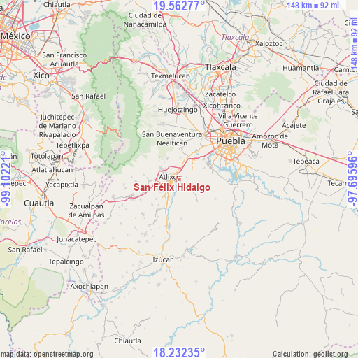
San Félix Hidalgo GPS coordinates[2]
18° 53' 55.968" North, 98° 23' 56.688" West
| Map corner | latitude | longitude |
|---|---|---|
| Upper-left | 19.56277°, | -99.10221° |
| Center: | 18.89888°, | -98.39908° |
| Lower-right: | 18.23235°, | -97.69596° |
| Map W x H: | 147.9×147.9 km | = 91.9×91.9mi |
| max Lat: | 32.7° ⇑67.1% North |
| San Félix Hidalgo: | 18.89888° |
| min Lat: | ⇓32.9% South 14.53588° |
| min Long | San Félix Hida | max Long |
| -117.105° | -98.39908° | -86.73105° |
| W 58.6%⇐ | ⇒41.4% E |
Elevation
Elevation of San Félix Hidalgo is 1822 m = 5978 ft, and this is 568.3 m = 1865 ft above average elevation for this country.
| Max E: |
3497 m = 11473 ft | 35.3% |
| San Félix Hidalgo | 1822 m 5978 ft | |
| Avg. | 1253.7 m = 4113 ft | |
Min E: |
-1 m = -3 ft | 64.7% |
See also: Mexico elevation on elevation.city.
Geographical zone
San Félix Hidalgo is located in North Torrid zone (between Equator and Tropic of Cancer). Distance of this Northern Tropic circle is 504.6 km =313.5 mi to North.| Distance of | km | miles | from San Félix Hidalgo |
|---|---|---|---|
| North Pole | 7905.7 | 4912.4 | to North |
| Arctic Circle | 5299.8 | 3293.1 | to North |
| Tropic Cancer | 504.6 | 313.5 | to North |
| Equator | 2101.4 | 1305.7 | to South |


Nearby cities:
15 places around San Félix Hidalgo: (largest is in red/bold)
• Atlixco
4 km =2.5 mi,  284°
284°
• Ciudad de Atlixco
4.3 km =2.7 mi, 277°
• El Encanto del Cerril
4.6 km =2.9 mi,  322°
322°
• Emiliano Zapata Nexatengo
2.2 km =1.4 mi,  211°
211°
• Emiliano Zapata los Molinos
5.5 km =3.4 mi,  5°
5°
• Emilio Portes Gil
5.9 km =3.7 mi,  62°
62°
• Juan Uvera
4.6 km =2.9 mi, 212°
• San Agustín Huixaxtla
2.1 km =1.3 mi, 6°
• San Félix Almazán
2.1 km =1.3 mi,  143°
143°
• San Isidro Huilotepec
2.6 km =1.6 mi, 139°
• San Juan Portezuelo
5.1 km =3.2 mi, 60°
• San Juan Tejaluca
0.6 km =0.4 mi,  273°
273°
• Santa Ana Yancuitlalpan (Chilhuacán)
1.6 km =1 mi,  182°
182°
• Santa Lucía Cosamaloapan
5.2 km =3.2 mi,  108°
108°
• Santo Domingo Atoyatempan
2.8 km =1.7 mi,  77°
77°
Sources, notices
• [Note1] Compared only with cities in Mexico existing in our database
• [Src1] Map data: © OpenStreetMap contributors (CC-BY-SA)
• [Src2] Other city data from geonames.org with taken over terms of usage.
• [Src3] Geographical zone / Annual Mean Temperature by Robert A. Rohde @ Wikipedia
