Nucatilí geodata
Nucatilí (Chiapas) is a populated place; located in Mexico in America/Mexico_City (GMT-6) time zone. With population of 691 people, there are 12594 cities with bigger population in this country. Compared to other cities in Mexico, 93% of cities are located further ↑North; 89.1% of cities are located further ←West and 67.6% of cities have higher elevation than Nucatilí. Note1


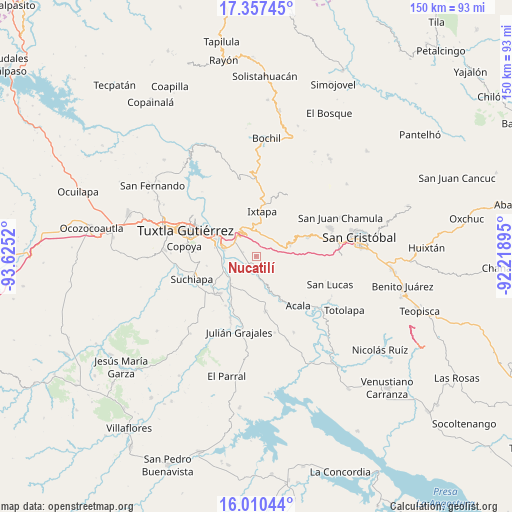
Nucatilí GPS coordinates[2]
16° 41' 6.468" North, 92° 55' 19.452" West
| Map corner | latitude | longitude |
|---|---|---|
| Upper-left | 17.35745°, | -93.6252° |
| Center: | 16.68513°, | -92.92207° |
| Lower-right: | 16.01044°, | -92.21895° |
| Map W x H: | 149.8×149.8 km | = 93.1×93.1mi |
| max Lat: | 32.7° ⇑93% North |
| Nucatilí: | 16.68513° |
| min Lat: | ⇓7% South 14.53588° |
| min Long | Nucatilí | max Long |
| -117.105° | -92.92207° | -86.73105° |
| W 89.1%⇐ | ⇒10.9% E |
Elevation
Elevation of Nucatilí is 550 m = 1804 ft, and this is 703.7 m = 2309 ft below average elevation for this country.
| Max E: |
3497 m = 11473 ft | 67.6% |
| Avg. | 1253.7 m = 4113 ft | |
| Nucatilí | 550 m = 1804 ft | |
Min E: |
-1 m = -3 ft | 32.4% |
See also: Mexico elevation on elevation.city.
Geographical zone
Nucatilí is located in North Torrid zone (between Equator and Tropic of Cancer). Distance of this Northern Tropic circle is 750.7 km =466.5 mi to North.| Distance of | km | miles | from Nucatilí |
|---|---|---|---|
| North Pole | 8151.8 | 5065.3 | to North |
| Arctic Circle | 5546 | 3446.1 | to North |
| Tropic Cancer | 750.7 | 466.5 | to North |
| Equator | 1855.2 | 1152.8 | to South |


Nearby cities:
15 places around Nucatilí: (largest is in red/bold)
• Adolfo López Mateos
9.1 km =5.7 mi,  160°
160°
• Amatal
9.6 km =6 mi,  236°
236°
• Aztlán
9.3 km =5.8 mi,  359°
359°
• Chiapa de Corzo
9.9 km =6.2 mi,  284°
284°
• Chiquinivalvo
7.9 km =4.9 mi,  71°
71°
• Cuauhtémoc
9.9 km =6.2 mi, 355°
• Cupasmí
9.1 km =5.7 mi,  261°
261°
• General Emiliano Zapata Dos
3.6 km =2.2 mi,  231°
231°
• Jobchenón (La Granadilla)
9.4 km =5.8 mi, 74°
• Juan del Grijalva
7.6 km =4.7 mi,  308°
308°
• Multajo
6.6 km =4.1 mi,  52°
52°
• Nueva Palestina (Nandayacuti)
6 km =3.7 mi,  245°
245°
• Nuevo Carmen Tonapac
3.8 km =2.4 mi,  289°
289°
• Ribera de Monte Rico (Nacamucuyi)
7.4 km =4.6 mi,  265°
265°
• Salvador Urbina
10.2 km =6.3 mi, 237°
Sources, notices
• [Note1] Compared only with cities in Mexico existing in our database
• [Src1] Map data: © OpenStreetMap contributors (CC-BY-SA)
• [Src2] Other city data from geonames.org with taken over terms of usage.
• [Src3] Geographical zone / Annual Mean Temperature by Robert A. Rohde @ Wikipedia
